
Formed 1975 Area 2,297 km² | Mayor Sandra Goudie | |
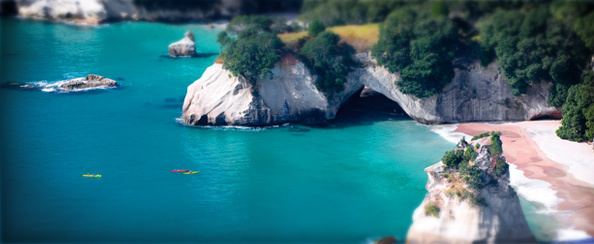 | ||
Wards Coromandel-Colville, Mercury Bay, Tairua/Pauanui, Whangamata, Thames Points of interest Te Whanganui‑A‑Hei (Cathedr, Hot Water Beach, Driving Creek Railway, Butterfly & Orchid Garden, Karangahake Gorge Destinations Thames, Coromandel, Whitianga, Whangamata, Te Whangan | ||
Thames coromandel district council coromandel peninsula our home
The Thames-Coromandel District is a territorial authority district in the North Island of New Zealand, covering all the Coromandel Peninsula and extending south to Hikutaia.
Contents
- Thames coromandel district council coromandel peninsula our home
- Map of Thames Coromandel District Waikato New Zealand
- Lifestyle testimonials thames coromandel district council
- Population
- Local government
- References
Map of Thames-Coromandel District, Waikato, New Zealand
It is administered by the Thames-Coromandel District Council, which has its seat in the town of Thames. It was the first district council to be formed in New Zealand, being constituted in 1975. The district lies within the Waikato Regional Council area.
Lifestyle testimonials thames coromandel district council
Population
The district had a population of 28,400 at the June 2016. From the 2006 census 6,756 live in Thames, 3,768 in Whitianga, 3,555 in Whangamata, and 1,476 in Coromandel.
Local government
The Thames-Coromandel District Council was formed from the amalgamation of the former Thames Borough and Coromandel County Council in 1975, and is led by the Mayor of Thames-Coromandel.