
Country Thailand Time zone ICT (UTC+7) Population 69,403 (2008) Province Chanthaburi Province | Seat Tha Mai Area 612.8 km² Postal code 22120 Geocode 2203 | |
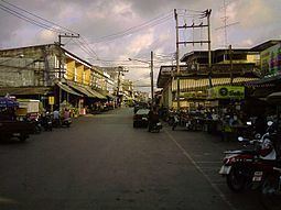 | ||
Tha Mai (Thai: ท่าใหม่, [tʰâː màj]) is a district (amphoe) of Chanthaburi Province, eastern Thailand.
Contents
Map of Tha Mai District, Chanthaburi, Thailand
History
The district was created in 1900, then named Khamong (โขมง). Four years later the district office was moved to the area of Wat Khao Phloi Waen, and the district name was changed accordingly to Phloi Waen (พลอยแหวน). When in 1917 the office was moved to Tambon Tha Mai, the district name was changed to be same as the central tambon.
Geography
Neighboring districts are (from the west clockwise) Na Yai Am, Kaeng Hang Maeo, Khao Khitchakut, Mueang Chanthaburi and Laem Sing of Chanthaburi Province. To the southwest is the Gulf of Thailand.
Administration
The district is subdivided into 14 subdistricts (tambon), which are further subdivided into 124 villages (muban). There are three subdistrict municipalities (thesaban tambon) - Tha Mai covers the whole tambon Tha Mai and Yai Ra, Noen Sung covers parts of tambon Khao Wua and Khao Baisi, and Nong Khla covers parts of Thung Bencha. There are further 12 tambon administrative organizations (TAO).
Missing numbers belong to tambon which now form the districts Kaeng Hang Maeo and Na Yai Am.