
Country United States County Texas Time zone Central (CST) (UTC-6) Elevation 1,063 m Population 995 (2013) | Incorporated 1908 Area code 580 Zip code 73949 Local time Thursday 1:45 AM | |
 | ||
Weather 3°C, Wind W at 19 km/h, 90% Humidity | ||
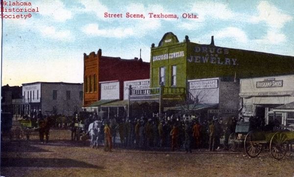
Texhoma is a town in Texas County, Oklahoma, United States. The population was 926 at the 2010 census. Texhoma is a divided city with the Texas–Oklahoma state border separating the town from Texhoma, Texas. The name of the town is a portmanteau of Texas and Oklahoma. Founded around the Rock Island Railroad laying tracks through the area, much of the town's local economy is from ranching and livestock.
Contents
- Map of Texhoma OK USA
- History
- Geography
- Demographics
- Education
- Transportation
- Sites of interest
- Notable people
- References
Map of Texhoma, OK, USA
History
Before No Man's Land was opened for settlers in 1890, the area now known as the Oklahoma Panhandle was sparsely settled ranchland. After the opening some of the land was filed on near the ranch headquarters, mostly by the cowboys, and sold to the ranch as soon as proved up. Expansion of the Rock Island Railroad tracks from Liberal, Kansas to Santa Rosa, New Mexico spurred the settlement's formation.
A post office named Loretta was established May 7, 1898, but the name and location was changed to Texhoma on November 12, 1901, as there was another Loretta, Oklahoma. Very few claims were filed on until the railroad was assured. The town grew quickly to a population near 1,000, serving as the closest railroad town to the people who lived as far north and west as present Boise City, and south into the Texas Panhandle to the present town of Gruver.
The land was quickly homesteaded and proved to be a rich agricultural area.
Geography
Texhoma is located at 36°30′16″N 101°47′11″W (36.504421, -101.786517). According to the United States Census Bureau, the town has a total area of 0.6 square miles (1.6 km2), all of it land.
Demographics
As of the census of 2000, there were 935 people, 352 households, and 254 families residing in the town. The population density was 1,495.0 people per square mile (573.0/km²). There were 408 housing units at an average density of 652.3 per square mile (250.0/km²). The racial makeup of the town was 81.60% White, 0.96% Native American, 0.21% Asian, 14.76% from other races, and 2.46% from two or more races. Hispanic or Latino of any race were 31.76% of the population.
There were 352 households out of which 39.2% had children under the age of 18 living with them, 60.5% were married couples living together, 5.7% had a female householder with no husband present, and 27.8% were non-families. 25.0% of all households were made up of individuals and 13.1% had someone living alone who was 65 years of age or older. The average household size was 2.66 and the average family size was 3.15.
In the town, the population was spread out with 31.2% under the age of 18, 9.1% from 18 to 24, 27.6% from 25 to 44, 18.6% from 45 to 64, and 13.5% who were 65 years of age or older. The median age was 32 years. For every 100 females there were 113.0 males. For every 100 females age 18 and over, there were 103.5 males.
The median income for a household in the town was $27,500, and the median income for a family was $36,667. Males had a median income of $23,229 versus $18,250 for females. The per capita income for the town was $12,938. About 11.7% of families and 15.8% of the population were below the poverty line, including 16.9% of those under age 18 and 17.8% of those age 65 or over.
Education
Texhoma students in both Texas and Oklahoma are served jointly by an unusual bi-state arrangement. Kindergarten through fourth grade students are served by the Texhoma Independent School District [1] in Texas, while fifth through twelfth grade students by Texhoma Public Schools in Oklahoma. It is the only city in Oklahoma where graduating students can attend either Oklahoma or Texas public universities at the in-state tuition rates for either.
Transportation
Sites of interest
Texhoma High School is housed in a pair of monolithic dome structures.
Registered Historic Places in the Texhoma area: