
Country United States FIPS code 48-31412 Elevation 968 m Zip code 79040 Local time Friday 7:58 PM | Time zone Central (CST) (UTC-6) GNIS feature ID 1358478 Area 2.8 km² Population 1,182 (2013) Area code 806 | |
 | ||
Weather 3°C, Wind SE at 11 km/h, 69% Humidity | ||
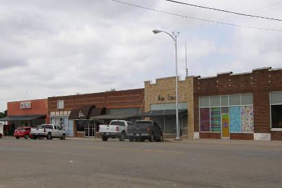
Gruver is a city in Hansford County, Texas, United States. The population was 1,162 at the 2000 census and 1,194 at the 2010 census. Farwell, in the center of Hansford County about three miles east of what later became Gruver, was established in 1880 by the Canott family of Illinois and was the first town in the county. Gruver was established shortly after and Farwell rapidly fell into oblivion after 1889, when it lost a county seat election to Hansford.
Contents
Map of Gruver, TX 79040, USA
Geography
Gruver is located at 36°15′46″N 101°24′19″W (36.262731, -101.405143).
According to the United States Census Bureau, the city has a total area of 1.1 square miles (2.8 km2), all of it land.
Demographics
At the 2000 census, there were 1,162 people, 439 households and 327 families residing in the city. The population density was 1,089.0 per square mile (419.3/km²). There were 509 housing units at an average density of 477.0/sq mi (183.7/km²). The racial makeup of the city was 80.12% White, 0.69% Native American, 17.21% from other races, and 1.98% from two or more races. Hispanic or Latino of any race were 28.31% of the population.
There were 439 households of which 39.9% had children under the age of 18 living with them, 64.9% were married couples living together, 5.7% had a female householder with no husband present, and 25.3% were non-families. 23.9% of all households were made up of individuals and 12.8% had someone living alone who was 65 years of age or older. The average household size was 2.65 and the average family size was 3.15.
31.3% of the population were under the age of 18, 6.5% from 18 to 24, 27.0% from 25 to 44, 20.2% from 45 to 64, and 15.0% who were 65 years of age or older. The median age was 35 years. For every 100 females there were 100.3 males. For every 100 females age 18 and over, there were 99.0 males.
The median household income was $32,031 and the median family income was $37,333. Males had a median income of $26,375 versus $17,143 for females. The per capita income for the city was $18,408. About 12.2% of families and 16.2% of the population were below the poverty line, including 21.5% of those under age 18 and 16.2% of those age 65 or over.
Education
The City of Gruver is served by the Gruver Independent School District and is the location of Gruver High School.
Tornado
On June 9, 1971, the largest observed tornado in history as of that time occurred just to the southwest of Gruver. Since then it has been bested by a 2004 tornado in Hallam, Nebraska and the May 2013 tornado in El Reno, Oklahoma.
The average width of the tornado along its path is estimated at 2,500 yards and the maximum width was approximately two miles along its fifteen-mile path. The tornado moved very slowly. Visibility was clear and witnesses reported seeing the tornado from as far as twenty five miles away.
The tornado was reported to have been on a direct track for the City of Gruver but veered away and spared the town from its effects. In spite of the size of tornado, damage was minor—total property damage from the tornado was put at $15,000. However, the tornado was accompanied by one to two inch hail that did significant damage to the wheat crops near the path of the tornado.
Climate
According to the Köppen Climate Classification system, Gruver has a semi-arid climate, abbreviated "BSk" on climate maps.