
Existed: 1939 – present Constructed 1939 | South end: I-35 Length 15.22 km | |
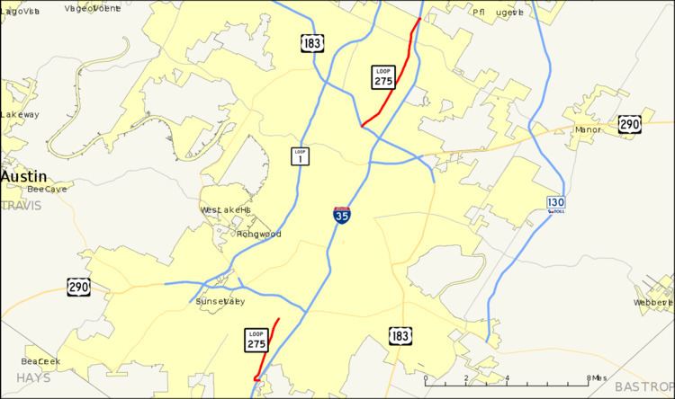 | ||
Loop 275 is a 9.454-mile (15.215 km), two-segment state-maintained roadway located in Austin, Texas.
Contents
Map of TX-275 Loop, Austin, TX, USA
History
Loop 275 was originally formed in 1939 as an alternate route for US 81, which traversed Austin at that time. In 1954, US 81 was realigned to form the Interregional Highway, which would later form the initial alignment for Interstate 35. Loop 275 was re-designated Business US 81. The name was reverted to the Loop 275 name in 1975.
At that time, Loop 275 followed Lamar Boulevard to downtown Austin. From there it followed Guadalupe Street and 1st Street over to Congress Avenue, where it crossed the Colorado River at the Ann W. Richards Congress Avenue Bridge and then continued south to eventually rejoin Interstate 35.
Lamar Boulevard and Congress Avenue are main arterial roads through Austin, and in 1986, maintenance of the central segments of those roads was returned to the city of Austin at its request. This resulted in the two-segment configuration of Loop 275 seen today.
Route Description
As currently configured, Loop 275 consists of two non-connected segments. The 6.0-mile (9.7 km) northern segment starts at an interchange at US 183, just west of Interstate 35. It proceeds north along Lamar Boulevard, passing FM 734, before terminating at the southbound frontage road of Interstate 35, just south of Howard Lane (Exit #246).
The 3.2-mile (5.1 km) southern segment starts at an intersection with Slaughter Lane just west of Interstate 35 (Exit #226B/227). It proceeds north along South Congress Avenue to its terminus at Williamson Creek south of US 290.
Junction list
The entire route is in Austin, Travis County.