
Existed: 1975 – present Spur 214 Spur 215 → Constructed 1975 | South end: LA 82 Counties: Jefferson Length 20.94 km | |
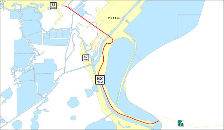 | ||
State Highway 82 or SH 82 is a state highway in the U.S. state of Texas that runs 13 miles (21 km) from the Louisiana border as a continuation of Louisiana Highway 82 to Port Arthur. This route was designated in 1975.
Contents
- Map of TX 82 Port Arthur TX 77640 USA
- Pecos Ward and Winkler Counties
- Jefferson County
- Major junctions
- References
Map of TX-82, Port Arthur, TX 77640, USA
Pecos, Ward, and Winkler Counties
SH 82 was originally designated by 1926 on a route from the Monahans south to Ft. Stockton, with a planned extension south to Sanderson. By 1928, SH 82 extended north to Kermit. By 1933, SH 82 extended north to the New Mexico Border. The planned extension was transferred to newly designated U.S. Highway 285 in 1935. In 1958, the route was renumbered as SH 18, to coordinate with its intersection with New Mexico State Road 18.
Jefferson County
In 1975, SH 82 was designated over its current route in Jefferson County from SH 87 to Louisiana Highway 82. In 1987, the route was extended 2.1 miles (3.4 km) to SH 73 incorporating the former Texas State Highway Spur 214.
Major junctions
The entire route is in Jefferson County.