
Existed: by 1933 – present Length 56.26 km | ||
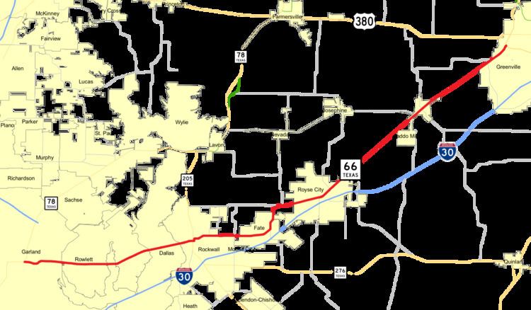 | ||
State Highway 66 or SH 66 is a state highway running from Garland to Greenville, roughly parallel to Interstate 30. Along the way, it passes through Rowlett, Rockwall, Fate, Royse City, and Caddo Mills. It also twice crosses Lake Ray Hubbard.
Contents
Map of Hwy 66, Texas, USA
History
SH 66 was previously designated first in 1926 as a route from Bogata northeast through Clarksville toward the Oklahoma town of Idabel. By 1931, this route had been added as a northern extent of SH 37, and was instead assigned along an ambitious route spanning the entire state from Wichita Falls to the Rio Grande near Hidalgo. In 1939, this entire second route was cancelled in favor of U.S. Highway 281.
The current route was designated in 1961, replacing FM 7 and U.S. Highway 67, which was rerouted atop I-30.