
Existed: 1987 – present Constructed 1987 | Length 11.4 km | |
 | ||
East end: FM 60 at College Station | ||
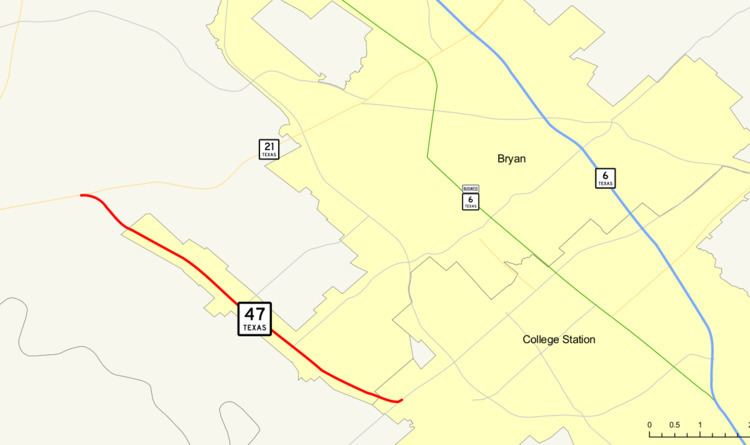
State Highway 47, or SH 47, runs from SH 21 at Texas A&M University-Riverside near Bryan southeastward to FM 60 near Easterwood Airport and Texas A&M University Research Park in College Station. This highway was designated in 1987.
Contents
Map of TX-47, Bryan, TX 77807, USA
Future
The SH 47 corridor is expected to be an area of major growth in the 2010s due to its proximity to the growth of the Texas A&M Health Science Center College of Medicine.
Previous routes
SH 47 was originally planned by 1926 along a previous section of SH 1A and SH 1C from near the intersection of the Texas, Arkansas, and Louisiana state borders, northwest through Atlanta, then northeast through Texarkana to the Arkansas border north of Texarkana. By 1930, the highway was rerouted west from Atlanta to Daingerfield, replacing SH 48. In 1939, this classification was cancelled when the route was transferred to SH 11.
Junction list
The entire route is in Brazos County.