
Elevation 3,680 m | ||
 | ||
First ascent 8 August 1884 by Moriz von Kuffner, guided by Christian Ranggetiner and E. Rubesoier (Teufelshorn) and 29 August 1879 by Gustav Gröger and Christian Ranggetiner (Glocknerhorn) Easiest route Trail from the Stüdl Hut over the Teischnitzkees and the Untere Glocknerscharte or the Grögerschneide Similar Schneewinkelkopf, Großer Bärenkopf, Eiskögele, Ramolkogel, Roter Knopf | ||
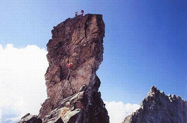
The Teufelshorn is a mountain in the Glockner Group in the Austrian Central Alps in the central part of the High Tauern. According to the literature it is 3,677 metres high, but the Austrian Federal Office for Metrology and Survey gives its height as 3,680 metres. It lies on the Northwest Ridge (Nordwestgrat) of Austria's highest peak, the neighbouring Großglockner, along which the border between the Austrian federal states of Tyrol (East Tyrol) and Carinthia runs. The Teufelshorn has a turret-like summit that juts about 30 metres above the massif itself and, together with the nearby and similar-looking Glocknerhorn (3,680 m), forms a twin peak. The Teufelshorn was first climbed on 8 August 1884 by Moriz von Kuffner, guided by Christian Ranggetiner and E. Rubesoier. The 3,680 metre high Glocknerhorn, by contrast, had already been conquered on 29 August 1879 by the Alpinists, Gustav Gröger and Christian Ranggetiner.