
- elevation 375 ft (114 m) - average 24.4 cu ft/s (1 m/s) Mouth River Avon | - elevation 230 ft (70 m) Basin area 73.81 km² Country United Kingdom | |
 | ||
- right Cutwell Brook, Wormwell Brook | ||
The Tetbury Avon, also known as the Little Avon or the Ingleburn (Anglo-Saxon - English river), is a tributary of the Bristol Avon. It is also referred to as the River Avon (Tetbury Branch). It rises at Tetbury in Gloucestershire in the West Country of England, and flows in a generally south easterly direction, joining the Sherston Avon at Malmesbury in Wiltshire. The water flow has been reduced by public water extraction form its source aquifer in the Cotswold Hills. In the past watermills were used for fulling wool and grinding corn. One working mill survives.
Contents
- Map of River Avon Tetbury Branch United Kingdom
- CourseEdit
- HistoryEdit
- Natural historyEdit
- HydrologyEdit
- References
Map of River Avon (Tetbury Branch), United Kingdom
CourseEdit
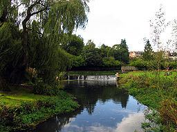
The Tetbury Avon rises at Wor Well to the north east of Tetbury in the Cotswold Hills. It flows first in a southerly direction, joined on the right bank by the Cutwell Brook at the south east of the town. The river now turns in south easterly direction into a steep valley through Estcourt Park, where it is joined on the right by the Wormwell Brook, which has its origin at Westonbirt. Passing through Shipton Wood the river forms a lake, created as part of the Estcourt Estate in the late 18th century. It then enters Wiltshire near the village of Brokenborough, flowing to the north of Malmesbury where it joins the Sherston Avon at the eastern edge of the town.
HistoryEdit
As is common amongst Cotswold streams many watermills were established from early times for fulling wool and grinding corn. Shipton Mill in the wood of the same name still produces organic wheat and rye flours. A mill at this site was recorded in the Domesday Book in 1086.
Natural historyEdit
A population of white-clawed crayfish in the Tetbury Avon has been eradicated by fungi hosted by the invasive North American signal crayfish.
HydrologyEdit
The Environment Agency has a gauging station at Brokenborough and reports a mean flow of 24.4 cubic feet per second (0.69 m3/s) with a maximum of 141 cubic feet per second (4.0 m3/s) and a minimum of 1 cubic foot per second (0.028 m3/s). It is believed that abstraction of public water supplies from the Great Oolite aquifer of the Cotswolds has reduced flows in the Tetbury Avon, making it difficult to maintain high water quality and having a negative effect on the ecology.