
Population 190 (2011 Census) Civil parish Brokenborough Local time Saturday 4:08 AM | OS grid reference ST918892 Unitary authority Dialling code 01666 Post town Malmesbury | |
 | ||
Weather 5°C, Wind SW at 11 km/h, 95% Humidity | ||
Brokenborough is a village and civil parish about 1 1⁄2 miles (2.4 km) northwest of Malmesbury, Wiltshire. The course of the Fosse Way Roman road forms the northwest boundary of the parish, and also the county boundary with neighbouring Gloucestershire. The Tetbury Avon, also called the Ingleburn, flows through the parish west of the village. The 2011 Census recorded the parish's population as 190.
Map of Brokenborough, Malmesbury, UK
The Domesday Book records that in 1086 Malmesbury Abbey held a large estate of 50 hides at Brokenborough. In the 11th and 12th centuries the abbey claimed it had held it since AD 956.
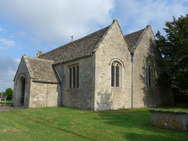
The Church of England parish church of St John the Baptist is 13th-century and has a four-bay north aisle. The building was restored in 1883 and is Grade II* listed.
The Great Barn at Brokenborough Farm, just south of the village, has 10 bays, nine cruck trusses, two porches and is probably 14th-century. It too is a Grade II* listed building. There was a farm with an even larger barn on a moated site somewhat further south, but it was demolished in the 17th century.
Brokenborough has a pub, the Horse Guards.