
Area 5 km² | Population Uninhabited (2012) | |
 | ||
Island groups Tuamotus, Tuamotu-Gambier Islands | ||
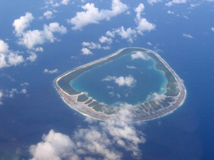
Tenarunga or Tenania, formerly Minto Island is a low, wooded and uninhabited atoll in the Acteon Group in the southeastern part of the Tuamotu Islands in French Polynesia. It is administratively a part of the Gambier Islands.
Contents
Map of Minto Island
Geography
Tenarunga is located 15 kilometres (9 mi) northwest of Matureivavao, 6 kilometres (4 miles) west of Vahanga and 1,375 kilometres (854 miles) southeast of Tahiti. It has a land area of 2.3 square kilometres (0.9 square miles) and a total area (lagoon inclusive) of 5 square kilometres (2 square miles). There are some buildings and a dock located on the north-east side of the island, indicating former and/or seasonal habitation.
The atoll's lagoon is not accessible from the sea.
History
The first recorded sighting of this atoll was made during the Spanish expedition of the Portuguese navigator Pedro Fernández de Quirós on 5 February 1606 under the name Las Cuatro Coronadas (the "four crowned" (by coconut palms)), however these observations were not fully documented. As such, the first unambiguous approach to the island was made in 1833 by navigator Thomas Ebrill on his merchant vessel Amphitrite and again in 1837 by Lord Edward Russell, commander of the H.M.S Actaeon, the name given to the group. It was previously owned by a man named Captain Nicholas but was redeemed in 1934.
Flora and fauna
The island is home to many rare species including the Tuamotu sandpiper.