
Mexico Ind. 1821 Municipality Est. 1900 Area 47.25 km² Area code 991 | Yucatan Est. 1824 Elevation 10 m Capital Tekantó | |
 | ||
Named for Place of the yellow flint | ||
Tekantó Municipality (In the Yucatec Maya Language: “Place where there is yellow flint”) is a small (47.25 km²) municipality in the Mexican state of Yucatán. The municipality was formed in 1900 and its municipal seat is the homonymous locality of Tekantó, at the end of highway 80, 54 km east of Merida.
Contents
- Map of TekantC3B3 Municipality YucatC3A1n Mexico
- Borders
- Shield
- Population
- Communities
- Nearby cities
- Climate
- Flora and fauna
- Architectural
- Popular celebrations
- Surrounding area
- History
- Economy
- Notables
- Education
- References
Map of Tekant%C3%B3 Municipality, Yucat%C3%A1n, Mexico
Borders
The municipalities that surround Tekantó Municipality are to the north: Suma and Teya, to the south: Izamal, to the east: Tepakán and to the west: Bokobá.
Shield
In 1990 the Mexican federal government asked all the municipalities to have their own shield or coat of arms. The City council then presided over by C. Manuel González Towers, decided to hold a contest to produce the shield's design. The design was adapted from submissions by several people. Some notable features of the shield are as follows. A sun with 13 rays that indicate the Mayan supraworld. An illustration of the Mayan chief Ah Kin Chel on a green background. Gold background with henequen that has 9 blades, that means the Mayan infraworld, the color gold has economic importance. At either side two branches interlaced by a plant called Kantó and that some say gave rise to the name of the town. At the bottom of the shield in front of the branches is a tape of silver with the words Siyan Kán Tekantó, this means the illustrious or famous Tekantó.
Population
The population of Tekantó is approximately 4,000. In the year 2000 the census record showed that 1,655 people spoke the indigenous language, Yucatec Maya. This is consistent with the state average which was 30% in 2000.
Communities
The municipality is made up from four principle communities, the municipal seat Tekantó along with its neighboring communities Tixkochoh 21.0138°N 89.0806°W / 21.0138; -89.0806 (Tixkochoh), San Francisco Dzon 20.9835°N 89.1433°W / 20.9835; -89.1433 (San Francisco Dzon) and Sanlatah 21.0426°N 89.1466°W / 21.0426; -89.1466 (Sanlatah)). Their populations are as follows: Tekantó 3224, Tixkochoh 455, San Francisco Dzon 127, Sanlatah 83; the census also included 53 people living outside of these communities, either in isolated rural homes or small communities like the hamlet of San Diego Rodriguez 20.9923°N 89.1143°W / 20.9923; -89.1143 (San Diego Rodriguez). In 2005 there were 942 houses in the municipality.
Nearby cities
The distances from the municipal seat to nearby cities are as follows:
Tekantó's rail station is on the (now disused) rail line that runs between Mérida and Valladolid via Izamal.
Climate
Warm, with rains during the early summer followed by droughts during the late summer. The annual average temperature is of 26.5 °C and the annual average rainfall is 50 millimeters. The winds are predominantly from the northeast. Relative humidity Annual Average, March 66% - December 89%. The Rainy Season is May through July.
Flora and fauna
Small portions of non-evergreen low forest with secondary vegetation in the ends northeast and the northwest. Including: poppy, bojom, ceiba, chehem, chichibé, pochote and flamboyán. The common animal species that are found in the area include: rabbit, raccoon, deer, armadillo, various snakes, iguanas and turtles; birds: dove, tzutzuy, quail and tórtola.
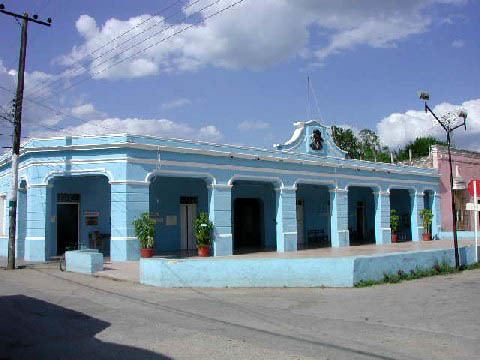
Architectural
San Augustin Tekantó is an impressive building and one of the largest churches in the Yucatán outside of Merida; it was an important early Franciscan Convent in this region.
The original mission dates from 1567. According to an inscription on the facade, the church was completed in 1688, over a hundred years after the mission's founding. Near to Tekantó are the hamlets of the ex-properties: Sanlatah and San Francisco Dzon.
Popular celebrations
From 26 to 28 August an annual fiesta is held in honor of the patron saint of Tekantó, San Augustin.
Between 15 and 26 November, an annual fair is held to celebrate Santo Christo de Citilcún. On November 15 each year a procession brings Santo Christo de Citilcún to Tekantó, after the procession there are firework displays and food for sale in the town square. Towards the end of the month there are various festivities including folk dancing, hosted at the town hall; an impromptu bullfighting ring is set up to host bull fights and other events.
Surrounding area
The ruins of Ake are 20 km to the south west of the locality of Tekanto, and Izamal with its world-famous monastery, Victorian era carriages, and mesoamerican pyramids is only 13 km to the south east.
History
Economy
Tekantó is a municipality that is located in the North central zone of Yucatán that is part of the denominated henequen zone, where the main agricultural crop is agave. Along with the surrounding municipalities the major productive activity for many years, until the end of the 20th Century, was the henequen industry.
With the decline of the henequen industry, a process of economic diversification occurred in Tekantó. Today in this area maize is main crop, along with kidney beans, various vegetables, watermelon and some varieties of chili peppers. In addition to these crops, pigs and poultry are farmed. Beekeeping is also common in the area.
Notables
Notable locals include Marrufo Cetina, Carlos Anastasio. Mandolinista and musical composer (1875–1932).
Education
Number of schools by educative level, to the year 2000, according to the Statistical Yearbook of the State of Yucatán, published by the INEGI: