
Country Iran Counties 13 Main language(s) Persian Population 13.27 million (2016) | Region Region 1 Time zone IRST (UTC+03:30) Area 18,814 km² Capital Tehran | |
 | ||
Destinations Tehran, Karaj, Damavand, Iran Clubs and Teams Persepolis F.C., Esteghlal F.C. Colleges and Universities Payame Noor University, University of Tehran, Islamic Azad University, University of Applied Science a, Shahid Beheshti University Points of interest Milad Tower, Golestan Palace, Azadi Tower, National Museum of Iran, Sa'dabad Complex | ||
Tehran Province (Persian: استان تهران Ostān-e Tehrān) is one of the 31 provinces of Iran. It covers an area of 18,909 square kilometres (7,301 sq mi) and is located to the north of the central plateau of Iran.
Contents
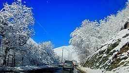
- Map of Tehran Province Iran
- Geography
- History
- Divisions
- Tehran province today
- Road transport
- National Rail Network
- Tehran Metro
- Airports
- Parks recreation and other attractions
- Mosques shrines mausoleums and tombs
- Churches
- Colleges and universities
- References
Map of Tehran Province, Iran
The province was put as part of First Region with its secretariat located in its capital city, Tehran, upon the division of the provinces into 5 regions solely for coordination and development purposes on June 22, 2014.
Tehran Province borders Māzandarān Province in the north, Qom Province in the south, Semnān Province in the east, and Alborz Province in the west. The metropolis of Tehran is the capital city of the province and of Iran. As of June 2005, this province includes 13 townships, 43 municipalities, and 1358 villages.
Tehran Province is the richest province of Iran as it contributes approximately 29% of the country's GDP. Furthermore, it houses approximately 18% of the country's population. Tehran Province is the most industrialized province in Iran; 86.5% of its population resides in urban areas and 13.5% of its population resides in rural areas.
The province gained importance when Tehran was claimed the capital by the Qajar dynasty in 1778. Today, Tehran, with a population of more than 7 million, is ranked amongst the 20 most populous metropolitan cities of the world.
Geography
The province of Tehran has over 12 million inhabitants and is Iran's most densely populated region. Approximately 86.5 percent reside in urban areas and 13.5 percent in rural areas of the province.
The largest rivers of this province are Karaj River and Jajrud River.
Mountain ranges such as The Alborz span the north; Savad Kooh and Firooz Kooh are located in the north east; Lavasanat, Qarah Daq, Shemiranat, Hassan Abad and Namak Mountains are in the southern areas; Bibi Shahr Banoo and Alqadr are situated in the south east and the heights of Qasr-e-Firoozeh being located to the east of the province.
Environmentally, the climate of Tehran province in the southern areas is warm and dry, but in the mountain vicinity is cold and semi-humid, and in the higher regions is cold with long winters. The hottest months of the year are from mid-July to mid-September when temperatures range from 28 °C (82 °F) to 30 °C (86 °F) and the coldest months experience 1 °C (34 °F) around December–January, but at certain times in winter it can reach −15 °C (5 °F). Tehran city has moderate winters and hot summers. Average annual rainfall is approximately 200 millimetres (7.9 in), the maximum being during the winter season. On the whole, the province has a semi arid, steppe climate in the south and an alpine climate in the north.
History
Tehran Province has several archeological sites indicating settlements dating back several thousand years. Until 300 years ago, Rey was the most prominent of the cities of the province. However, the city of Tehran rose to become the larger city and capital of Iran by 1778, and since then has been the political, cultural, economic, and commercial nucleus of Iran.
Tehran has over 1,500 historical sites of cultural significance registered with the Cultural Heritage Organization of Iran. The oldest of these in Tehran province are the remains of two sites in Firuzkuh County that date back to the 4th millennium BCE.
Divisions
Tehran Province is sub-divided into fourteen Counties (shahrestan), listed below with their populations at the 2011 Census:
The counties comprise a number of municipalities:
Tehran province today
Tehran is the commercial heart of Iran. Tehran province has over 17,000 industrial units employing 390,000 people, 26% of all units in Iran. The province contains 30% of Iran's economy, and comprises 40% of Iran's consumer market. The province has three hydro dams namely Latiyan, Lar, and Amir Kabir as well as two natural lakes, providing the water supply of Tehran and the province.
The province contains 170 mines, over 330 square kilometres of forests, and over 12800 square kilometres of pasture.
Generally speaking, year round, regions such as the southern slopes of the Alborz Mountains, especially in the mountains, valleys, and rivers and artificial lakes formed behind the great dams of Amir Kabir, Latiyan and Lar along with natural lakes of Jaban and Tarr provide considerable recreation for the province.
Moreover, due to excessive snowfall in the northern areas of the province during the winter season, the Alborz mountains form an excellent environment for winter sports such as skiing. Dizin, Shemshak, and Tochal are the most popular skiing resorts.
Road transport
Tehran Province is covered with and connected to other provinces with a big Freeway and Expressway network:
National Rail Network
The city of Tehran is connected to the North, South, West and East with railway. It has weekly trains for Istanbul. Tehran is the headquarters of RAJA (Iran national railway). There maybe plans to build high speed railway lines from Tehran to Mashhad and Esfahan.
Tehran Metro
Tehran is served by a system of metro of 3 urban lines (1, 2, 4) and one suburban line (5) serving Karaj and Tehran western suburbs. There are plans to extend the system to 8 urban lines and 4 express suburban lines.
Airports
Tehran Province has two main passenger airports:
It also has numbers of air force bases.
Parks, recreation and other attractions
Mosques, shrines, mausoleums, and tombs
Churches
Colleges and universities
Tehran province's major universities are: