
First ascent 1929 | Elevation 3,757 m Prominence 245 m Easiest route Mountaineering | |
 | ||
Similar Mount Owen, Middle Teton, South Teton, Grand Teton, Mount Moran | ||
Teewinot Mountain (12,330 feet (3,758 m)) is the sixth highest peak in the Teton Range, Grand Teton National Park, Wyoming. The name of the mountain is derived from the Shoshone Native American word meaning "many pinnacles". The peak is northeast of the Grand Teton, and the two are separated from one another by the Teton Glacier and Mount Owen. Teewinot Mountain rises more than 5,500 feet (1,700 m) above Jenny Lake. The 40 miles (64 km) long Teton Range is the youngest mountain chain in the Rocky Mountains, and began their uplift 9 million years ago, during the Miocene. Several periods of glaciation have carved Teewinot Mountain and the other peaks of the range into their current shapes. Broken Falls is one of the tallest cascades in Grand Teton National Park and descends 300 feet (91 m) down the eastern slopes of Teewinot Mountain.
Contents
Map of Teewinot Mountain, Wyoming 83414, USA
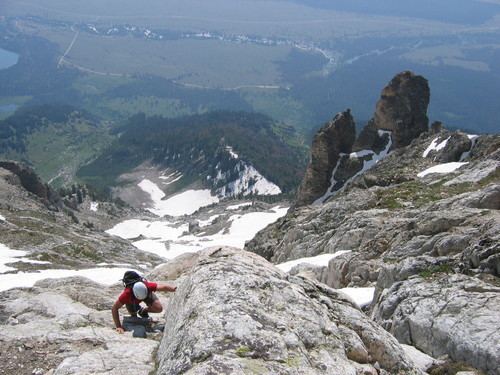
ClimbingEdit
Teewinot Mountain is most easily ascended via the eastern face, which finishes with a somewhat exposed Class 4 scramble to the tiny summit. An unmarked climbers' trail, known as the Apex Trail, leads most of the way up the mountain from the Lupine Meadows area.