
Country United States ZIP codes 36301, 36305 Elevation 101 m Population 2,406 (2013) | Time zone Central (CST) (UTC-6) FIPS code 01-75096 Local time Monday 12:05 PM Area code 334 | |
 | ||
Weather 24°C, Wind S at 11 km/h, 64% Humidity Area 19.42 km² (19.17 km² Land / 21 ha Water) | ||
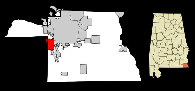
Taylor is a town in Geneva and Houston counties in the U.S. state of Alabama. Taylor was first settled in the 1870s, named after an early family that helped secure the first post office. It was not incorporated until almost a century later in June 1967. It is part of the Dothan, Alabama Metropolitan Statistical Area. At the 2010 census the population was 2,375, up from 1,898 in 2000.
Contents
Map of Taylor, AL, USA
Geography
Taylor is located in western Houston County at 31°10′6″N 85°28′5″W (31.168331, -85.468016). A rural portion of the town extends west into Geneva County. Taylor is bordered to the northeast by Dothan, to the southeast by Rehobeth, and to the southwest by Malvern. Alabama State Route 52 (Hartford Highway) passes through the northern part of Taylor, leading northeast 6 miles (10 km) to the center of Dothan and southwest 9 miles (14 km) to Slocomb.
According to the U.S. Census Bureau, Taylor has a total area of 7.5 square miles (19.4 km2), of which 7.4 square miles (19.1 km2) is land and 0.1 square miles (0.2 km2), or 1.09%, is water.
Demographics
As of the census of 2000, there were 1,898 people, 699 households, and 552 families residing in the town. The population density was 267.4 people per square mile (103.2/km²). There were 751 housing units at an average density of 105.8 per square mile (40.8/km²). The racial makeup of the town was 93.05% White, 3.79% Black or African American, 0.79% Native American, 0.26% Asian, 0.74% from other races, and 1.37% from two or more races. 1.11% of the population were Hispanic or Latino of any race.
There were 699 households out of which 47.2% had children under the age of 18 living with them, 61.9% were married couples living together, 12.3% had a female householder with no husband present, and 21.0% were non-families. 18.3% of all households were made up of individuals and 4.6% had someone living alone who was 65 years of age or older. The average household size was 2.72 and the average family size was 3.09.
In the town, the population was spread out with 31.7% under the age of 18, 7.6% from 18 to 24, 35.6% from 25 to 44, 17.9% from 45 to 64, and 7.2% who were 65 years of age or older. The median age was 31 years. For every 100 females there were 97.5 males. For every 100 females age 18 and over, there were 94.0 males.
The median income for a household in the town was $40,664, and the median income for a family was $44,181. Males had a median income of $32,401 versus $22,321 for females. The per capita income for the town was $16,327. About 8.7% of families and 9.9% of the population were below the poverty line, including 12.8% of those under age 18 and 10.6% of those age 65 or over.
2010 census
As of the census of 2010, there were 2,375 people, 835 households, and 639 families residing in the town. The population density was 329.9 people per square mile (127.7/km²). There were 966 housing units at an average density of 134.2 per square mile (51.9/km²). The racial makeup of the town was 87.5% White, 7.2% Black or African American, 0.8% Native American, 0.1% Asian, 2.4% from other races, and 2.1% from two or more races. 5.2% of the population were Hispanic or Latino of any race.
There were 835 households out of which 43.0% had children under the age of 18 living with them, 53.8% were married couples living together, 18.2% had a female householder with no husband present, and 23.5% were non-families. 19.3% of all households were made up of individuals and 6.1% had someone living alone who was 65 years of age or older. The average household size was 2.84 and the average family size was 3.22.
In the town, the population was spread out with 31.6% under the age of 18, 8.2% from 18 to 24, 30.4% from 25 to 44, 22.1% from 45 to 64, and 7.8% who were 65 years of age or older. The median age was 31.5 years. For every 100 females there were 96.3 males. For every 100 females age 18 and over, there were 89.5 males.
The median income for a household in the town was $43,603, and the median income for a family was $49,500. Males had a median income of $31,795 versus $29,276 for females. The per capita income for the town was $16,833. About 16.9% of families and 21.0% of the population were below the poverty line, including 32.3% of those under age 18 and 10.5% of those age 65 or over.