
Country United States ZIP codes 36301, 36303, 36305 Area 16.2 km² Population 1,403 (2013) Area code 334 | Time zone Central (CST) (UTC-6) FIPS code 01-64152 Elevation 74 m Local time Monday 12:18 AM | |
 | ||
Weather 18°C, Wind SW at 6 km/h, 94% Humidity | ||
Rehobeth is a town in Houston County, Alabama, United States. One source indicated the town incorporated in 1996. It is part of the Dothan, Alabama Metropolitan Statistical Area. At the 2010 census the population was 1,297, up from 993.
Contents
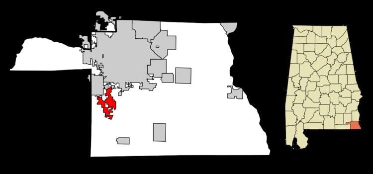
Map of Rehobeth, AL 36301, USA
Geography
Rehobeth is located at 31°8′7″N 85°26′10″W (31.135245, -85.436008).
According to the U.S. Census Bureau, the town has a total area of 6.3 square miles (16 km2), of which 6.3 square miles (16 km2) is land and 0.04 square miles (0.10 km2) (0.32%) is water.
Demographics
As of the census of 2000, there were 993 people, 375 households, and 292 families residing in the town. The population density was 158.6 people per square mile (61.2/km²). There were 399 housing units at an average density of 63.7 per square mile (24.6/km²). The racial makeup of the town was 96.68% White, 0.81% Black or African American, 0.40% Native American, 0.10% Asian, 0.40% from other races, and 1.61% from two or more races. 1.51% of the population were Hispanic or Latino of any race.
There were 375 households out of which 38.9% had children under the age of 18 living with them, 61.3% were married couples living together, 12.0% had a female householder with no husband present, and 22.1% were non-families. 20.3% of all households were made up of individuals and 8.5% had someone living alone who was 65 years of age or older. The average household size was 2.65 and the average family size was 3.04.
In the town, the population was spread out with 27.5% under the age of 18, 8.9% from 18 to 24, 30.0% from 25 to 44, 21.9% from 45 to 64, and 11.8% who were 65 years of age or older. The median age was 37 years. For every 100 females there were 96.6 males. For every 100 females age 18 and over, there were 91.0 males.
The median income for a household in the town was $34,267, and the median income for a family was $39,625. Males had a median income of $31,513 versus $21,518 for females. The per capita income for the town was $17,149. About 12.6% of families and 14.2% of the population were below the poverty line, including 20.5% of those under age 18 and 13.9% of those age 65 or over.
2010 census
As of the census of 2010, there were 1,297 people, 485 households, and 388 families residing in the town. The population density was 205.9 people per square mile (80.1/km²). There were 528 housing units at an average density of 83.8 per square mile (32.6/km²). The racial makeup of the town was 95.9% White, 1.5% Black or African American, 0.8% Native American, 0.2% Asian, 0.8% from other races, and .9% from two or more races. 2.5% of the population were Hispanic or Latino of any race.
There were 485 households out of which 35.5% had children under the age of 18 living with them, 66.0% were married couples living together, 8.7% had a female householder with no husband present, and 20.0% were non-families. 17.7% of all households were made up of individuals and 7.6% had someone living alone who was 65 years of age or older. The average household size was 2.67 and the average family size was 3.02.
In the town, the population was spread out with 26.2% under the age of 18, 7.6% from 18 to 24, 26.9% from 25 to 44, 27.2% from 45 to 64, and 12.1% who were 65 years of age or older. The median age was 37.3 years. For every 100 females there were 93.0 males. For every 100 females age 18 and over, there were 98.5 males.
The median income for a household in the town was $51,328, and the median income for a family was $55,156. Males had a median income of $37,647 versus $31,898 for females. The per capita income for the town was $20,195. About 7.3% of families and 9.4% of the population were below the poverty line, including 11.2% of those under age 18 and 20.0% of those age 65 or over.