
Pronunciation [tɑwɑŋ ˈbɔɡ.dɔ] First ascent 1956 Elevation 4,374 m Listing Ultra-prominent peak | Parent range Mongol-Altai Mountains Type Cultural Prominence 2,342 m | |
 | ||
Similar Khüiten Peak, Nairamdal Peak, Tsambagarav, Belukha Mountain, Kharkhiraa | ||
Altai tavan bogd mountain climbing 100 years anniversary
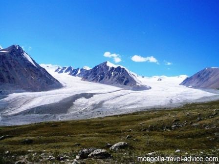
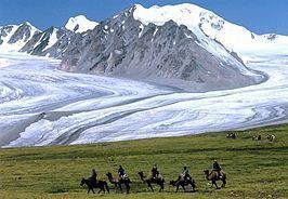
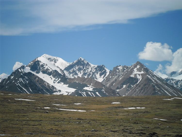
The Tavan Bogd (Mongolian: Таван богд, [tɑwɑŋ ˈbɔɡ.dɔ], lit. "five saints") is a mountain massif in Mongolia, on the border with China and Russia. Its highest peak, the Khüiten Peak (formerly also known as Nairmadal Peak) is the highest point of Mongolia at 4374 meters above sea level.
Contents
- Altai tavan bogd mountain climbing 100 years anniversary
- Climbing at khuiten peak altai tavan bogd mountain
- International borders
- Peaks
- Glaciation
- National Parks and protected areas
- References
The Tavan Bogd massif is located mostly within the Bayan-Olgii Province of Mongolia; its northern slopes are in Russia's Altai Republic, and western, in China's Burqin County.
Besides the Khüiten Peak, the Tavan Bogd massif includes four other peaks: Nairamdal, Malchin, Bürged (eagle) and Olgii (motherland).
Climbing at khuiten peak altai tavan bogd mountain
International borders
According to the relevant trilateral agreements and published topographic maps, the junction point of the China–Russia border, the China–Mongolia border, and the Mongolia–Russia border is the top of a peak with the elevation of 4081 or 4104 m, at the coordinates 49°10′13.5″N 87°48′56.3″E The mountain peak is referred to in the agreements and maps as the Tavan Bogd Peak (Russian: Таван-Богдо-Ула, Tavan-Bogdo-Ula; Mongolian: Таван Богд Уул, Tavan Bogd Uul), or Mount Kuitun (Chinese: 奎屯山; pinyin: Kuítún shān).
Due to its remote and hard to access location, on a mountain covered with eternal snows, the three states have agreed not to install a border marker at the tripoint.
Other sources claim that the tripoint is called Nairamdal Peak, but this is not confirmed either by official agreements or by maps.
Some other peaks of the Tavan Bogd massif are located on the China–Mongolia border or the Mongolia–Russia border. In particular, the massif tallest point, the Khüiten Peak, is located on the China–Mongolia border, about 2.5 km south of the tripoint. In the past, it was known as the "Friendship Peak" (Nairamdal Uul in Mongolian, or Youyi Feng 友谊峰 in Chinese).
Peaks
The main peaks of the Tavanbogd massif are:
Glaciation
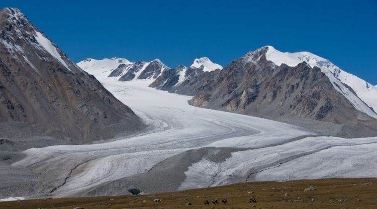
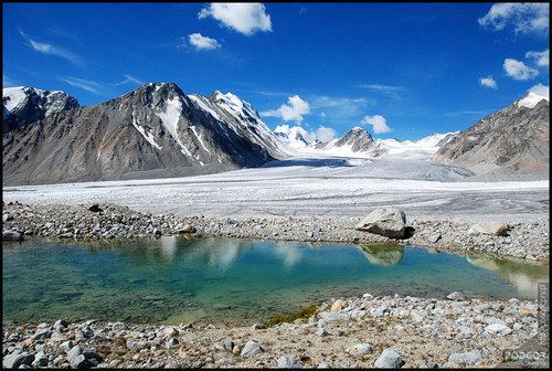
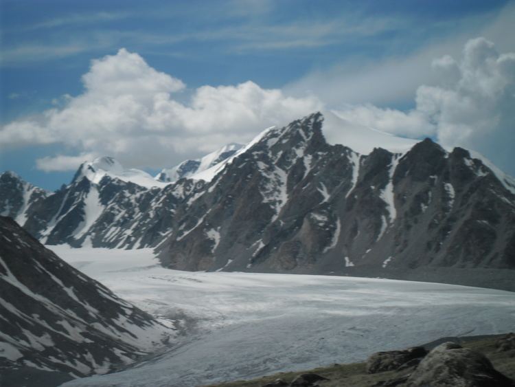
According to satellite measurements, the total area of the glaciation in the Tavan Bogd massif area amounted to 204 km2 in 2009. The glaciates area was 213 km2 in 1989; in other words, the glaciers lost 4.2% of their area over the 20 years.
Out of the countries that share the massif, the largest glaciated area is in Mongolia; it includes the Potanin Glacier (Mongolia's longest) and the Alexandra Glacier.
According to a 2011 estimate, the northern (Russian) slope of the Tavan Bogd massif contains 12 glaciers, which cover the total of 22.8 km2. According to the Russian researchers, the glaciers of the massif's northern slope have lost 11% of their area between 1962-2002, and another 12% in 2002-2009.
National Parks and protected areas
Special protected areas have been designated in all three nations sharing the Tavan Bogd.
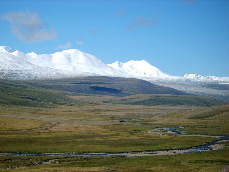
The Mongolian part of the Tavan Bogd massif is within the Altai Tavan Bogd National Park. The park covers 6,362 km². It includes the lakes Khoton, Khurgan, and Dayan. The protected area offers a home for many species of alpine animal, such as the Argali sheep, Ibex, Red deer, Beech marten, Moose, Snow cock, and Golden eagle.
On the Russian side of the border, the Ukok Plateau, adjacent to the Tavan Bogd massif from the north, is part of the UNESCO World Heritage Site called the Golden Mountains of Altai.
The glacier-fed stream on the western, Chinese, slope of the massif flow into the small Akkul Lake (阿克库勒湖), which in its turn drains into the Kanas Lake farther south; the Kanas Lake area has been designated AAAAA scenic area by the China National Tourism Administration. An area of 5,588 km² has been designated as the Kanas Nature Reserve (zh:喀纳斯湖自然风景保护区).