
River mouth Vienne232 m (761 ft) Length 107 km Basin area 1,030 km² | Basin size 1,030 km (400 sq mi) Discharge 18.9 m³/s | |
 | ||
Main source Limousin785 m (2,575 ft) Progression | ||
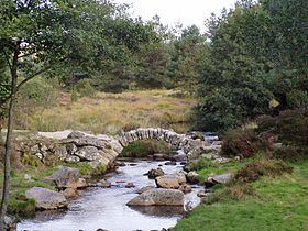
The Taurion (Occitan: Taurion), as it is known in Haute-Vienne, or Thaurion, as it is known in Creuse, is a 107 km long river in western France, tributary of the Vienne river.
Map of Le Taurion, France
Its source is at an altitude of 785 m on the Plateau de Millevaches, on the flanks of the Puy de Groscher, near Gentioux in the commune of Gentioux-Pigerolles, in the Creuse département.
It passes under the bridge of Sénoueix, feeds the Lac de Lavaud-Gelade, before crossing the Rigole du diable. It flows into the Vienne on the right bank at Saint-Priest-Taurion, at 232 m elevation. Hydro-electric dams are built along the river, (La Roche Talamy, l'Étroit, Saint-Marc, Chauvan).
The Taurion flows through the following départements and towns:
References
Taurion Wikipedia(Text) CC BY-SA