
Intercommunality Plateau de Gentioux Area 79.29 km² | Canton Gentioux-Pigerolles Population (2008) 380 Local time Sunday 2:31 AM | |
 | ||
Weather 7°C, Wind S at 13 km/h, 86% Humidity | ||
Gentioux-Pigerolles (Occitan: Genciòus) is a commune in the Creuse department in the Nouvelle-Aquitaine region in central France.
Contents
Map of 23340 Gentioux-Pigerolles, France
Geography
An area of lakes, forestry, quarries and farming, comprising three villages and several hamlets situated in the upper valleys of both the Maulde and Thaurion rivers, some 15 miles (24 km) southwest of Aubusson, at the junction of the D8, D992, D35 and the D16 roads. The commune is in the national park of the Millevaches (1000 lakes, not cows).
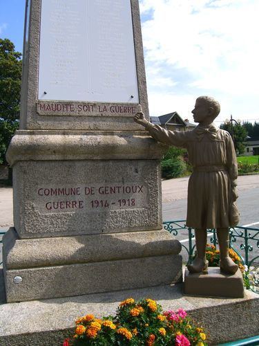
Sights
References
Gentioux-Pigerolles Wikipedia(Text) CC BY-SA