
Admin. region Stuttgart Time zone CET/CEST (UTC+1/+2) Area 117.2 km² Population 4,802 (31 Dec 2008) | District Main-Tauber-Kreis Postal codes 97993, 97990 (Standorf Local time Friday 1:22 PM Administrative region Stuttgart | |
 | ||
Weather 9°C, Wind SE at 23 km/h, 45% Humidity Points of interest Tauber, Fingerhutmuseum, Keltenwall | ||
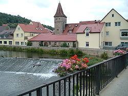
Creglingen is a town in the Main-Tauber district of Baden-Württemberg, Germany.
Contents
Map of Creglingen, Germany
Subdivision
The town Creglingen contains the following Stadtteile(since the municipal reform of 1972): Archshofen, Blumweiler, Craintal, Erdbach, Finsterlohr (together with the villages Schonach, Burgstall and Seldeneck), Frauental, Freudenbach, Münster, Niederrimbach, Oberrimbach, Lichtel, Reinsbronn (together with the village of Niedersteinach), Reutsachsen, Schirmbach, Schmerbach, Schön, Schwarzenbronn, Waldmannshofen (together with the village of Sechselbach and the hamlets Fuchshof und Seewiesenhof), Wolfsbuch, Weiler.
History
The Celts who founded the town between 200 and 100 B.C. also farmed the surrounding plateaus and valleys. In 1349, Creglingen received its town charter from Emperor Karl IV (Charles IV).