
Local time Monday 11:24 AM | ||
 | ||
Weather 7°C, Wind NE at 14 km/h, 91% Humidity | ||
Tattenhoe and Tattenhoe Park are adjacent districts of Milton Keynes, England, in the ancient parish of Tattenhoe. It is located at the south-western edge of the city, not far from the ruins of Snelshall Priory. It contains Howe Park Wood, one of England's few remaining primeval woodlands (though certainly coppiced) and home to a wide variety of wildlife, notably Odonata.
Contents
Map of Tattenhoe, Milton Keynes, UK
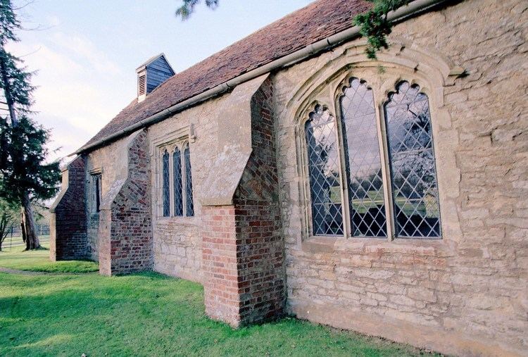
The village was abandoned in the 16th century and had its own moated manor house and church (1540, perhaps 12th century). By the time redevelopment began, it consisted of just three farms and St. Giles' Church, but was recognised as a village (rather than a hamlet) because it had its own parish.
In January 2006, the Haredim community of Stamford Hill (London) considered establishing a new settlement at Tattenhoe Park, but decided against it.
Its name is an Old English language word meaning 'Tatta's spur of land'. The village was first recorded (in the 12th century) as 'Thateo'; the village has also been known as Tattenho, Totenho (13th century); Tottynho (16th-17th century); Tattenhall (18th-19th century) and was given as Tottenhoe in Magna Britannia (1806).
Tattenhoe tournament trailer
Civil parish
The district is in the modern civil parish of Shenley Brook End (where the 2011 Census population was included).