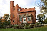
Area 262.8 km² Local time Sunday 9:41 PM | Website www.tapa.ee Population 7,849 (2014) | |
 | ||
Weather 6°C, Wind W at 29 km/h, 71% Humidity Points of interest | ||
Tapa Parish (Estonian: Tapa vald) is a rural municipality in Lääne-Viru County in northern Estonia.
Contents
Map of Tapa, L%C3%A4%C3%A4ne-Viru County, Estonia
The administrative centre of the municipality is the town of Tapa. It is located 70 km east of Estonia's capital, Tallinn.
History
Tapa Parish was established in October 2005 by merging the town of Tapa with Lehtse and Saksi rural municipalities.
Local government
Chairman of the Council (Estonian: volikogu esimees):
Mayor (Estonian: vallavanem):
Populated places
There is one town Tapa, one small borough Lehtse and 25 villages: Imastu, Jootme, Jäneda, Karkuse, Kuru, Kõrveküla, Linnape, Loksu, Lokuta, Läpi, Läste, Moe, Nõmmküla, Näo, Patika, Piilu, Pruuna, Rabasaare, Raudla, Rägavere, Räsna, Saiakopli, Saksi, Tõõrakõrve, Vahakulmu.
References
Tapa Parish Wikipedia(Text) CC BY-SA
