
Time zone WIB (UTC+7) Website www.tanahdatar.go.id | Area code(s) +62 752 Area 1,337 km² Population 356,085 (2014) | |
 | ||
Points of interest Batu Batikam, Lembah Anai Waterfall, Istano Basa Pagaruyung, Fort van der Capellen, Malibo Anai | ||
Mtb trail tanah datar batusangkar nagari balimbing padang ganting west sumatera
Tanah Datar is a regency (kabupaten) in West Sumatra province, Indonesia. The regency has a population of 338,584 at the 2010 Census, which according to official estimates had risen to 356,085 in January 2014. The capital of the regency is Batusangkar. The town of Padang Panjang is also geographically located within the regency but constitutes a municipality (kota otonom) of its own.
Contents
- Mtb trail tanah datar batusangkar nagari balimbing padang ganting west sumatera
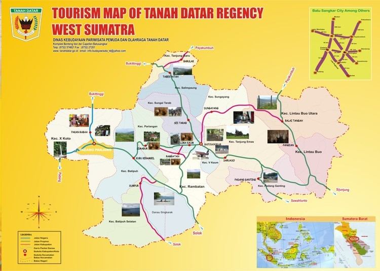
- Map of Tanah Datar Regency West Sumatra Indonesia
- Administration
- References
Map of Tanah Datar Regency, West Sumatra, Indonesia
Tanah Datar has several tourist attractions including the Pagaruyung Palace (Istano Pagaruyuang) with its museum, Sanskrit and Malay language stone inscriptions from the 14th century, several sites with megaliths (batu tagak), and the village Pandai Sikat (Pandai Sikek), where the traditional songket (kain balapak) is still woven. The northern part of Lake Singkarak is also situated in Tanah Datar.
Administration
Tanah Datar is divided into fourteen districts (kecamatan), listed below with their populations at the 2010 Census: