
Founded 1860 Postal code 91400 Population 5,089 (2011) | Time zone UTC -3 Dial plan +598 4315 (+4 digits) Local time Saturday 4:10 PM | |
 | ||
Weather 27°C, Wind E at 19 km/h, 55% Humidity | ||
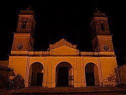
Tala is a small city in the north of the Canelones Department of southern Uruguay.
Contents
- Map of Tala Canelones Department Uruguay
- Location
- History
- Population
- Places of worship
- Famous people
- References
Map of Tala, Canelones Department, Uruguay
Tala is also the name of the municipality to which the city belongs.
Location
The city is located on the intersction of Route 7 with Route 12, about 25 kilometres (16 mi) north of San Jacinto, 20 kilometres (12 mi) east of San Ramón and 18 kilometres (11 mi) south of Fray Marcos of the Florida Department.
History
Tala was founded as a "Pueblo" (village) by Decree of 2 May 1860. On 15 May 1925, its status was elevated to "Villa" (town) by the Act of Ley Nº 7.837. On 28 April 1960, its status was further elevated to "Ciudad" (city) by the Act of Ley Nº 12.708.
Population
According to the 2011 census, Tala had a population of 5,089. In 2010, the Intendencia de Canelones had estimated a population of 9,499 for the municipality during the elections.
Source: Instituto Nacional de Estadística de Uruguay