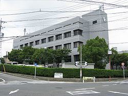
- Tree Cinnamomum camphora Area 25.92 km² Local time Sunday 2:00 AM | District Chita Population 42,738 (May 2015) | |
 | ||
Region Chūbu regionTōkai region Weather 8°C, Wind NE at 18 km/h, 88% Humidity | ||
Taketoyo (武豊町, Taketoyo-chō) is a town located in Chita District, Aichi Prefecture, Japan. As of May 2015, the town had an estimated population of 42,738 and a population density of 1650 persons per km². The total area was 25.82 square kilometres (9.97 sq mi).
Contents
- Map of Taketoyo Chita District Aichi Prefecture Japan
- Geography
- Neighboring municipalities
- History
- Economy
- Education
- Railway
- Highway
- Noted people from Taketoyo
- References
Map of Taketoyo, Chita District, Aichi Prefecture, Japan
Geography
Taketoyo is located in the northeast corner of Chita Peninsula in southern Aichi Prefecture, bordered by Mikawa Bay to the east. Part of the town’s area is within the borders of the Mikawa Wan Quasi-National Park.
Neighboring municipalities
History
The village of Taketoyo was established in the early Meiji period cadastral reforms of 1878. It was raised to town status on February 15, 1891.
An Imperial decree in July 1899 established Taketoyo as an open port for trading with the United States and the United Kingdom.
On October 5, 1954, Taketoyo annexed the neighboring village of Fuki, also from Chita District.
Economy
The traditional industries in the town center around the production of soy sauce, miso and cotton products.
Due to its location near the Greater Nagoya metropolis and the port facilities at Kinuura Port, Taketoyo is home to numerous factories, including glass manufacturing, and pharmaceuticals. Chubu Electric Power also has a large electrical generating facility, the Taketoyo Thermal Power Plant located in Taketoyo. The traditional industries in the town center around the production of soy sauce, miso and cotton products.
