
- Tree Sakura Population 29,144 (Sep 2015) Bird Green pheasant | Region Kantō Area 193.6 km² Local time Saturday 9:49 PM | |
 | ||
Weather 4°C, Wind E at 14 km/h, 80% Humidity Points of interest Mt. Tatsuware, Tsuchigatake, Mt. Yokone | ||
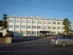
Takahagi (高萩市, Takahagi-shi) is a city located in Ibaraki Prefecture, in the northern Kantō region of Japan. As of September 2015, the city had an estimated population of 29,144 and a population density of 151 persons per km². Its total area was 193.58 km².
Contents
- Map of Takahagi Ibaraki Prefecture Japan
- Geography
- Surrounding municipalities
- History
- Economy
- Education
- Train
- Highway
- Local attractions
- References
Map of Takahagi, Ibaraki Prefecture, Japan
Geography
Located in northern Ibaraki Prefecture, Takahagi is bordered by the Pacific Ocean to the east, and by Fukushima Prefecture to the northwest.
Surrounding municipalities
History
During the Edo period, parts of the modern city of Takahagi were administered by Matsuoka Domain, one of the feudal domains of the Tokugawa shogunate. With the creation of the municipalities system after the Meiji Restoration on April 1, 1889, the town of Matsubara, and the villages of Matsuoka, Takaoka, Kurosaki and Kushigata was established within Taga District, Ibaraki). Matsuoka was raised to town status on April 17, 1928. Matsubara was renamed Takahagi on October 1, 1937.
Takahagi merged with Matsubara, Takaoka and Kurosaki on November 23, 1954 and was raised to city status. The city suffered considerable damage in the 2011 Tōhoku earthquake and tsunami
Economy
Takahagi was once part of the Joban coal fields, but the mines were exhausted by the 1960s. Since that time, the economy had been orientated towards light manufacturing and food processing. Agriculture and commercial fishing also play subordinate roles.
Education
Takahagi has five elementary schools, four middle schools and three high schools.