
Local time Thursday 6:46 AM | Region Kantō Population 43,809 (Sep 2015) | |
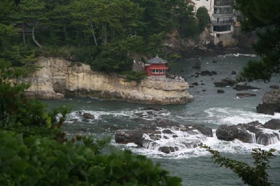 | ||
Weather 3°C, Wind NW at 21 km/h, 78% Humidity Points of interest Rokkakudō, Tenshin Memorial Museum, Hanazono Shrine, Tenshiniseki Memorial Park, Jorenji | ||
Kitaibaraki (北茨城市, Kitaibaraki-shi) is a city located in Ibaraki Prefecture, in the northern Kantō region of Japan. As of September 2015, the city had an estimated population of 43,809 and a population density of 235 persons per km². Its total area was 186.80 square kilometres (72.12 sq mi).
Contents
- Map of Kitaibaraki Ibaraki Prefecture Japan
- Geography
- Surrounding municipalities
- History
- Economy
- Education
- Railway
- Highway
- Sister city relations
- Local attractions
- Festivals
- Notable people from Kitaibaraki
- References
Map of Kitaibaraki, Ibaraki Prefecture, Japan
Geography
Kitaibaraki is located in northern Ibaraki Prefecture, bounded by Fukushima Prefecture to the north and the Pacific Ocean to the east. As its name implies, it is the northernmost city within Ibaraki. Approximately 80% of the total area is mountainous forest. The eastern region is low ground facing the ocean with spacious open flatland along the Okita and Satone Rivers. It is approximately 57 kilometers to the northeast of Mito, the prefectural capital.
Surrounding municipalities
History
The towns of Otsu and Hirakata and the village of Kitanakago were created with the establishment of the municipalities system on April 1, 1889. Kitanakago became the town of Isohara on January 1, 1925. On March 31, 1956 the towns of Otsu, Hirakata, Isohara and the villages of Sekinan, Sekimonto and Minaminakago merged to form the city of Kitaibaraki. The city suffered from serious damage caused by the tsunami from the 2011 Tōhoku earthquake.
Economy
Commerce developed during the Edo period along the Tanagura highway, which was also called the 'Road of Salt'. The area flourished with ports for water transportation and coal mining began at the end of the Edo period. Kitaibaraki is now a regional commercial center with some light manufacturing. The Joban Coal Field, which was the mainstay of the economy from the Meiji period to the mid-Showa period, closed in 1976. Commercial fishing from Otsu fishing port, notably for angler fish is also a factor in the local economy.
Education
Kitaibaraki has 12 elementary schools, five middle schools, and one high school.