
Country Taiwan | ||
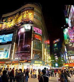 | ||
Major Cities TaipeiNew TaipeiKeelung | ||
The Taipei–Keelung metropolitan area (Chinese: 臺北基隆都會區; pinyin: Táiběi-Jīlóng Dūhùiqū) or Greater Taipei area / region (大臺北地區) is the largest metropolitan area in Taiwan. It was recognized officially until 2010, and included Taipei, Taipei County (now New Taipei), and Keelung.
Contents
- Map of Taipei Metropolitan Area Taiwan
- Definition
- Geography
- Geographical Subdivision
- Rail
- Air
- Bus
- References
Map of Taipei Metropolitan Area, Taiwan
Definition
The official definition of the Taipei–Keelung metropolitan area by the government until 2010 was Taipei, Taipei County and Keelung.
Some international reports consider Taipei–Keelung–Taoyuan (臺北基隆桃園都會區; Táiběi–Jīlóng–Táoyuán Dūhùiqū) as a real complete metropolitan area.
Geography
Due to the geographical characteristics of the area, the Taipei–Keelung metropolitan area roughly corresponds to areas located within the Taipei Basin. Taipei City serves as the core of the metropolitan area where the government of Taiwan and major commercial districts are located.
Geographical Subdivision
The metropolitan area contains Taipei City, Keelung City and New Taipei City. The geographical subdivision listed as followed.
Rail
The Taipei–Keelung metropolitan area is served by routes of the Taiwan Railway Administration (Western Line) and Taiwan High Speed Rail which connect the area with all parts of the island. For rapid transit, Taipei and New Taipei are served by the Taipei Metro with daily trips of over 2.0 million passengers.
Air
The area is served by Taiwan Taoyuan International Airport for international flights while Songshan Airport is primarily for domestic flights, international flights to Tokyo and Seoul; and also cross-strait flights.
Bus
An extensive bus system serves the metropolitan area.