
COSPAR ID 2006-058A Period 1.5 hours Launch mass 370 kg Perigee 413,000 m | Operator AFRL Manufacturer MicroSat Systems Launch site MARS LP-0B Launch mass 370 kg Apogee 424,000 m Launch date 16 December 2006 | |
 | ||
Similar TacSat‑3, TacSat‑4, TacSat‑1, GeneSat‑1, USA‑165 | ||
Minotaur i space launch tacsat 2 satellite
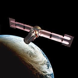
TacSat-2 (also known as JWS-D1 or RoadRunner) is an experimental satellite built by the USAF's Air Force Research Laboratory with an operational life expected to be not more than one year as part of the 'Advanced Concept Technology Demonstration' program.
Contents
- Minotaur i space launch tacsat 2 satellite
- Tacsat 2 launch
- Purpose
- Launch
- Systems
- Platform
- Camera Telescope
- Signals Intelligence
- Orbit
- Developers
- References
Tacsat 2 launch
Purpose
The TacSat series of experimental spacecraft are designed to allow military commanders on a battlefield to request and obtain imagery and other data from a satellite as it passes overhead. Collected data will be delivered to field commanders in minutes rather than hours or days. The sensor on TacSat-2 can collect color images sharp enough to distinguish ground objects as small as 1 meter in diameter.
Launch
TacSat-2 was launched on 16 December 2006 from the Mid-Atlantic Regional Spaceport using an Orbital Sciences Minotaur launch vehicle. The Mid-Atlantic Regional Spaceport is a commercial space launch facility located on the Delmarva Peninsula 5 miles (8.0 km) west of Chincoteague, Virginia.
Systems
Satellites in the TacSat series were planned to use commercial or available launchers, and largely off-the-shelf components, in order to reduce costs.
Platform
The space platform was built by MicroSat Systems of Littleton, Colorado. The core avionics of the spacecraft including command and data handling, electrical power switching and distribution, and subsystem & payload interfaces is handled by an Integrated Avionics Unit (IAU) developed by Broad Reach Engineering. The spacecraft flight software consists of the low level drivers, and bus manager functionality provided by Broad Reach Engineering, ADCS Software by ASI, and a number of higher level applications by 3rd parties, most notably the Autonomous Tasking Experiment (ATE) by Interface & Control Systems.
Camera / Telescope
The developers originally asked for bids from contractors for a camera. These were priced at around US$10 million. The team then bought a high-end observatory telescope costing around $20,000 and added a camera sensor ($2 million), delivering a sensor capable of 1m ground resolution.
The telescope has 50 cm (0.5 m) aperture and was from RC Optical Systems.
Signals Intelligence
A signals intelligence payload, called the Target Indicator Experiment, detects radio wave emitters and can be used in concert with receivers on other platforms such as the US Navy's P-3C maritime patrol aircraft.
Other systems include:
Orbit
The near circular orbit had a height of 410 km at an inclination of 40 degrees to the equator. TacSat-2 decayed on February 5, 2011.
Developers
Apart from the Air Force Research Laboratory (AFRL), other organisations participating included: