
COSPAR ID 2002-055A Inclination 1.64° Rocket Atlas II | Mission duration 11 years (planned) Inclination 1.64° Launch date 5 December 2002 Bus Boeing 601 | |
 | ||
Launch mass 3,180 kilograms (7,010 lb) Longitude 153° West; 151° West; ~42-40° West (2004—) Similar TDRS‑9, TDRS‑7, TDRS‑3, TDRS‑6, TDRS‑1 | ||
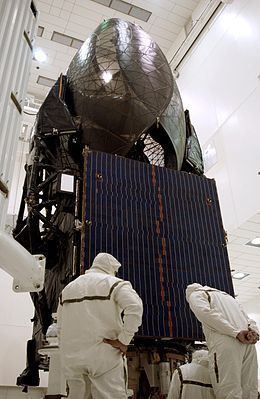
TDRS-10, known before launch as TDRS-J, is an American communications satellite which is operated by NASA as part of the Tracking and Data Relay Satellite System. It was constructed by the Boeing Satellite Development Center, formerly Hughes Space and Communications, and is based on the BSS-601 satellite bus. It was the third and final Advanced TDRS, or second-generation Tracking and Data Relay Satellite, to be launched.
Contents
History
The final Atlas IIA rocket was used to launch TDRS-J, under a contract with International Launch Services. The launch occurred at 02:42 UTC on 5 December 2002, from Space Launch Complex 36A at the Cape Canaveral Air Force Station. TDRS-10 separated from its carrier rocket into a geosynchronous transfer orbit. At 01:00 UTC on 14 December, following a series of apogee burns, it reached geostationary orbit.
Deployment
TDRS-J was initially positioned in geostationary orbit at a longitude 153 degrees west of the Greenwich Meridian, and following on-orbit testing, it received the operational designation TDRS-10. In December 2003, it was moved to 151.5° west, arriving the next month. It remained there until June, when it departed for 42.3° west. It arrived there in November, and has since been slowly drifting eastwards. By November 2005, it was at 42° west, and in November 2006, it was recorded to have been at 41.6° west. In July 2009, it was at 40.75° west.