Phone number 0268-62-1111 Population 29,726 (Oct 2016) | Area 112.4 km² Local time Tuesday 7:41 AM | |
 | ||
Website www.city.tomi.nagano.jp Weather 1°C, Wind W at 6 km/h, 76% Humidity Points of interest Yunomaru Ski Area, Tōmi Chūō Park, Shiratori Shrine, Unnojukurekishiminzoku Museum, Mt Eboshi | ||
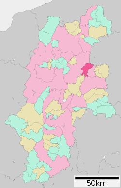
Tōmi (東御市, Tōmi-shi) is a city located in central Nagano Prefecture, in the Chūbu region of Japan. As of 1 October 2016, the city had an estimated population of 29,726 and a population density of 265 persons per km². Its total area was 112.37 square kilometres (43.39 sq mi).
Contents
- Map of Tomi Nagano Prefecture Japan
- Geography
- Surrounding municipalities
- History
- Education
- Railway
- Highway
- International relations
- Local attractions
- Notable people
- References
Map of Tomi, Nagano Prefecture, Japan
Geography
Tōmi is located in central Nagano Prefecture, at an elevation of between 500 and 1000 meters. The Chikuma River divides the city into two parts.
Surrounding municipalities
History
Tōmi is located in former Shinano Province. The modern city of Tōmi was established on April 1, 2004, from the merger of the village of Kitamimaki (from Kitasaku District), and the town of Tōbu (from Chiisagata District).
Education
Tōmi has four public elementary schools and one public middle school operated by the city government, and one public high school operated by the Nagano Prefectural Board of Education. Previously the city had a Brazilian school, Colégio Pitágoras-Brasil. It moved to Minowa and changed its name to Nagano Nippaku Gakuen.
