
Time zone CET (UTC+1) Area code 94 Local time Tuesday 4:30 AM | Area 67.73 km² Population 9,136 (2004) Postal code 9970 | |
 | ||
Weather 10°C, Wind NE at 3 km/h, 81% Humidity | ||
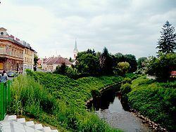
Szentgotthárd (German: St. Gotthard; Slovene: Monošter) is the westernmost town of Hungary. It is situated on the Rába River near the Austrian border, and is home to much of Hungary's small Slovene ethnic minority.
Contents
Map of Szentgotth%C3%A1rd, Hungary
The town took its name from, and grew up round, the Cistercian Szentgotthárd Abbey, founded here in 1183.
In 1664, it was the site of the Battle of Saint Gotthard, where an Austrian army led by Raimondo Montecuccoli defeated the Ottoman Empire so that the Turks had to agree to the Peace of Vasvár, which held until 1683.
A second Battle of Saint Gotthard in 1705 was a victory for Rákóczi's Anti-Habsburg Hungarian rebels.
The town serves as the cultural centre of the Hungarian Slovenes.
References
Szentgotthárd Wikipedia(Text) CC BY-SA