
Pebbly beach formation geology sydney basin
The Sydney Basin is both a structural entity and a depositional area, now preserved on the east coast of New South Wales, Australia and with some of its eastern side now subsided beneath the ocean.
Contents
- Pebbly beach formation geology sydney basin
- Coal and tuff ash layers of the austinmer tongarra coal measures sydney basin
- Geography
- Hydrology
- References
It has also lost area on its western side by erosion. Confusion may arise because geologists use the term "Basin" both to mean an area in which deposition is occurring and at other time to mean the rocks formed by that deposition - which are slightly different 'takes' on the matter.
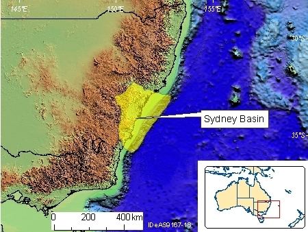
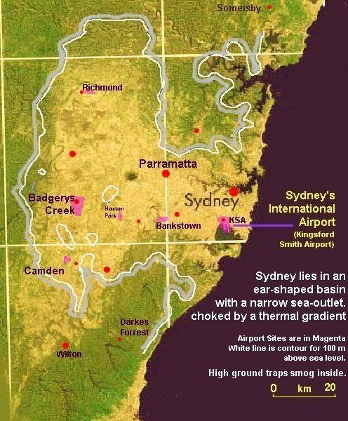
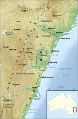
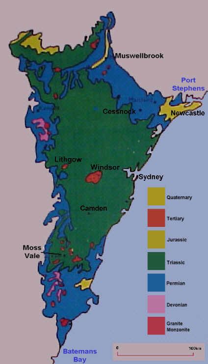
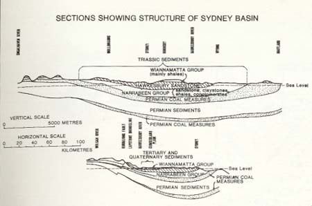
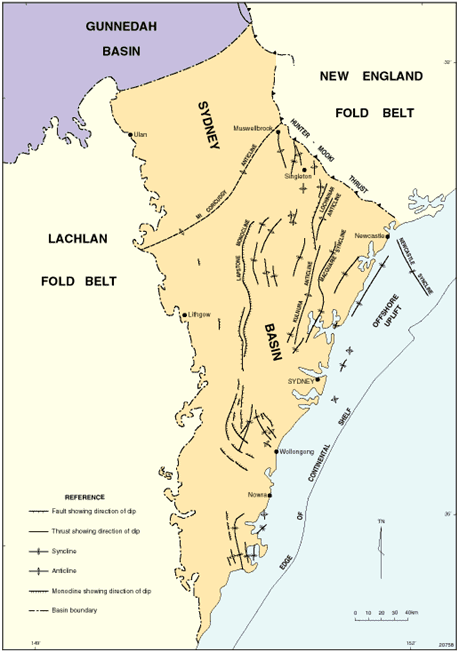
The Sydney Basin consists of Permian and Triassic sedimentary rocks. It is named for the city of Sydney which is centred within it and stretches from Newcastle in the north to Batemans Bay in the south, and west to the Great Dividing Range. The basin is also home to the major centres of Newcastle and Wollongong, and contains economically significant reserves of coal. Sydney’s famous harbour and the sculptured cliffs of the Blue Mountains are signature formations of relatively hard upper strata of sandstone. The basin contains the UNESCO World Heritage-listed Greater Blue Mountains Area.
Coal and tuff ash layers of the austinmer tongarra coal measures sydney basin
Geography
Definitions of the boundaries and what comprises the Sydney basin vary significantly. The Australian Government classifies the basin as an interim Australian bioregion consisting of 3,629,597 hectares (8,968,930 acres).
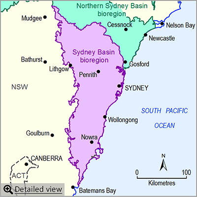
According to NSW Primary Industries, the basin extends through approximately 350 kilometres (220 mi) of coastline from Newcastle in the north to Durras Lake (near Batemans Bay) in the south. From Durras Lake the western boundary continues in a line through Lithgow to around Ulan (near Mudgee). To the north the boundary extends 120 kilometres (75 mi) along the Liverpool Range to a point 80 kilometres (50 mi) north of Muswellbrook, and then runs 200 kilometres (120 mi) back to the coast at Newcastle.
To the east the basin continues to the edge of the continental shelf. The total area of the basin is approximately 44,000 square kilometres (17,000 sq mi) onshore plus 5,000 square kilometres (1,900 sq mi) offshore. The centre of the basin is located around 30 kilometres (19 mi) west of the Sydney central business district at Fairfield.
Hydrology
The hydrology of the basin comprises three main drainage basins as defined by the New South Wales Office of Water that lie entirely or mainly within the geography of the basin; namely the Central Coast catchment, the Hawkesbury-Nepean catchment, and the Sydney Metropolitan catchment.
In addition, some of the rivers of the Hunter-Central Rivers catchment and the Southern Rivers catchment also lie mainly in the basin. In the Hunter-Central Rivers catchment, the Hunter River sub-catchment forms the northern boundary of the basin. In the Southern Rivers catchment, the Illawarra sub-catchment and the Shoalhaven sub-catchment forms the southern boundary.