
Population 445 Civil parish Syderstone Area 9.94 km² | OS grid reference TF829326 Sovereign state United Kingdom | |
 | ||
District | ||
Syderstone is a civil parish in the English county of Norfolk, near the town of Fakenham. It covers an area of 9.94 km2 (3.84 sq mi) and had a population of 532 in 224 households at the 2001 census, the population reducing to 445 at the 2011 Census. For the purposes of local government, it falls within the district of King's Lynn and West Norfolk.
Map of Syderstone, UK
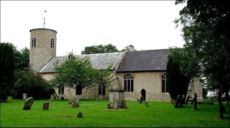
Its church, St. Mary's, is one of 124 round-tower churches in Norfolk.
It is famous for the Natterjack Toad which have been seen near the popular but overgrown duck pond. Syderstone is also known for its large common, which spans roughly 4 square miles (10 km2). Much wildlife can be seen there including snakes, hares, rabbits and foxes.
In a field alongside the road that passes the duck pond there is a World War II Home Guard pill box. On a bright spring day in 1944 or 1945 two P-51 Mustangs collided over Barwick Hall Farm near Stanhoe. One of the Mustangs crashed on Syderstone Common, killing the pilot.