
Time zone SAST (UTC+2) Area 3,835 km² Black african population 12.4% Native english speakers 4.7% Mayor N.G. Myburgh (DA) | Wards 5 Municipal code WC034 White population 17.4% Native afrikaans speakers 85.1% | |
 | ||
Gold coins for sale swellendam local municipality south africa
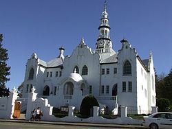
Swellendam Municipality is a municipality located in the Western Cape Province of South Africa. As of 2011 it had a population of 35,916. Its municipality code is WC034.
Contents
- Gold coins for sale swellendam local municipality south africa
- Brand new lamborghini for sale swellendam local municipality south africa
- Geography
- Conservation areas
- Politics
- References
Brand new lamborghini for sale swellendam local municipality south africa
Geography
The municipality covers an area of 3,835 square kilometres (1,481 sq mi) around the lower Breede River Valley, from the confluence of the confluence of the Breede River and Sonderend River downstream to the Breede River mouth on the Indian Ocean. It also extends westwards up the Sonderend River and northwards across the Langeberg mountains into the Little Karoo around the Warmwaterberg. The municipality abuts on the Cape Agulhas Municipality to the south, the Theewaterskloof Municipality to the west, the Langeberg Municipality to the northwest, the Kannaland Municipality to the northeast and the Hessequa Municipality to the east.
According to the 2011 census the municipality has a population of 35,916 people in 10,139 households. Of this population, 68.8% describe themselves as "Coloured", 17.4% as "White", and 12.4% as "Black African". The first language of 85.1% of the population is Afrikaans, while 6.9% speak Xhosa and 4.7% speak English.
The principal town and location of the municipal headquarters is Swellendam, which as of 2011 had a population of 17,537. Suurbraak (pop. 2,252) is situated east of Swellendam at the southern end of Tradouws Pass which cuts through the Langeberg, while Barrydale (pop. 4,156) is at the other end of the pass on the edge of the Little Karoo. Buffeljagsrivier (pop. 1,439) is situated southeast of Swellendam on the river of the same name. Malgas (pop. 44) is located at a pontoon ferry on the Breede River, the last crossing of the river before it reaches the ocean. Infanta (pop. 90) is situated at the mouth of the river on its southern bank.
Conservation areas
The most significant conservation areas are:
Politics
The municipal council consists of eleven members elected by mixed-member proportional representation. Six councillors are elected by first-past-the-post voting in six wards, while the remaining five are chosen from party lists so that the total number of party representatives is proportional to the number of votes received. In the election of 3 August 2016, the Democratic Alliance (DA) won a majority of seats on the council.
The following table shows the results of the 2016 election.
The local council sends one representative, a member of the Democratic Alliance, to the council of the Overberg District Municipality.