
Population 174 (in 2011) Civil parish Swallowcliffe Local time Sunday 1:45 AM | OS grid reference ST965271 Unitary authority Dialling code 01747 | |
 | ||
Weather 6°C, Wind NW at 11 km/h, 95% Humidity | ||
Swallowcliffe is a small village and civil parish located approximately 13 miles (21 km) west of Salisbury, Wiltshire, England. Its centre is one mile north of the A30.
Contents
Map of Swallowcliffe, Salisbury, UK
Geography
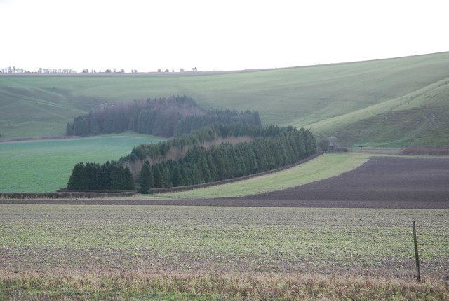
The parish of Swallowcliffe is composed of chalk escarpments and greensand terraces to the south and upper greensand wooded hills to the south west; also to the north east, where Swallowcliffe Wood is prominent. Cutting through the hills south to north is the spring filled valley where the village first developed.
History
From medieval times to the 20th century, Swallowcliffe was a rural backwater, its inhabitants engaged in agriculture and associated crafts and trades. Much of the Open Field system, possibly Saxon, survived until the enclosures of the late 18th century. From 1742, with the new Earl of Pembroke as owner of SWALLOWCLIFT manor, the 18th century estate maps show the developing settlement pattern, with the Norman church at the hub.
The 19th century was a period of reform and renewal. In 1843 a new church was built away from the spring soaked valley and soon afterwards, the tannery by the stream was closed and the house became the Royal Oak public house. With Pembroke patronage a new vicarage and a school were built to the west of the old village heralding, in that direction, 20th century development. The sale of the Swallowcliffe Pembroke Estate in 1918, mainly to tenants, marked the end of an era of aristocratic landlords in the locality. The population of Swallowcliffe had reached a peak of 371 in 1871, before falling in consequence of agricultural depression and changes in farming methods.
Modern development of Swallowcliffe stemmed from the rapid social change of the 20th century, accelerated by improvements in transport and two world wars. Mechanisation played its part in the exodus from agricultural employment. Already by c.1908, a new principal farm house had been built on the outskirts of Swallowcliffe and the Manor Farmhouse, like the Mill, (c.1900) shifted to private ownership and use. This set the trend within the village for the rest of the century, with small farmsteads, labourer's cottages, wheelwright and blacksmith shop, village general store, post office, schoolhouse and barns to follow. The exodus from the land continued, while the demand by incomers for the accessible country abode, to “improve” for full or weekend use, expanded. Social change is mirrored in this change of ownership. By the Millennium, the transformation of the old village was clear, with only a few of its inhabitants “born and bred” in Swallowcliffe or working in its ancient tradition of agriculture.
Archaeology
A Saxon bed burial dating to the seventh century AD was discovered within a reused Bronze Age barrow on Swallowcliffe Down in 1996. The burial was that of a young female aged between 18 and 25, laid on an ash-wood bed with elaborate iron-work fittings, and surrounded by a collection of grave-goods of high quality. The full report was published by English Heritage in 1989.
Amenities
The Anglican Church of St Peter, built in 1842-43, is Grade II* listed.
The Royal Oak pub closed in 2007 and reopened in 2015 after it was bought by a consortium of villagers. The building is from the early 18th century and is Grade II listed.
The village has no school. A National School was opened in 1843 and closed in 1973.