
Country United States FIPS code 19-76620 Elevation 351 m Zip code 50477 Local time Saturday 7:33 PM | Time zone Central (CST) (UTC-6) GNIS feature ID 0462129 Area 65 ha Population 163 (2013) Area code 641 | |
 | ||
Weather 12°C, Wind SE at 8 km/h, 42% Humidity | ||
Swaledale is a city in Cerro Gordo County, Iowa, United States. The population was 165 at the 2010 census. It is part of the Mason City Micropolitan Statistical Area.
Contents
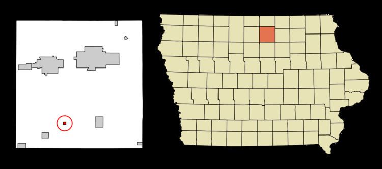
Map of Swaledale, IA 50477, USA
Geography
Swaledale is located at 42°58′41″N 93°18′56″W (42.977956, -93.315537).
According to the United States Census Bureau, the city has a total area of 0.25 square miles (0.65 km2), all of it land.
2010 census
As of the census of 2010, there were 165 people, 77 households, and 46 families residing in the city. The population density was 660.0 inhabitants per square mile (254.8/km2). There were 83 housing units at an average density of 332.0 per square mile (128.2/km2). The racial makeup of the city was 97.6% White and 2.4% from other races. Hispanic or Latino of any race were 3.0% of the population.
There were 77 households of which 22.1% had children under the age of 18 living with them, 50.6% were married couples living together, 6.5% had a female householder with no husband present, 2.6% had a male householder with no wife present, and 40.3% were non-families. 32.5% of all households were made up of individuals and 15.6% had someone living alone who was 65 years of age or older. The average household size was 2.14 and the average family size was 2.76.
The median age in the city was 48.4 years. 20% of residents were under the age of 18; 3.6% were between the ages of 18 and 24; 22.5% were from 25 to 44; 29.7% were from 45 to 64; and 24.2% were 65 years of age or older. The gender makeup of the city was 49.7% male and 50.3% female.
2000 census
As of the census of 2000, there were 174 people, 75 households, and 48 families residing in the city. The population density was 682.9 people per square mile (268.7/km²). There were 83 housing units at an average density of 325.8 per square mile (128.2/km²). The racial makeup of the city was 100.00% White.
There were 75 households out of which 29.3% had children under the age of 18 living with them, 57.3% were married couples living together, 4.0% had a female householder with no husband present, and 36.0% were non-families. 30.7% of all households were made up of individuals and 17.3% had someone living alone who was 65 years of age or older. The average household size was 2.32 and the average family size was 2.96.
In the city, the population was spread out with 24.7% under the age of 18, 10.9% from 18 to 24, 23.6% from 25 to 44, 20.7% from 45 to 64, and 20.1% who were 65 years of age or older. The median age was 38 years. For every 100 females there were 95.5 males. For every 100 females age 18 and over, there were 104.7 males.
The median income for a household in the city was $28,906, and the median income for a family was $34,167. Males had a median income of $25,000 versus $17,917 for females. The per capita income for the city was $11,710. About 4.2% of families and 5.2% of the population were below the poverty line, including 9.4% of those under the age of eighteen and none of those sixty five or over.