
Area 1,489 km² Population 43,575 (2013) | Founded 1851 | |
 | ||
Website www.co.cerro-gordo.ia.us Points of interest Dr GC Stockman House, MacNider Art Museum, Surf Ballroom, Lime Creek Nature Center, The Music Man Square Destinations | ||
Cerro Gordo County is a county located in the U.S. state of Iowa. As of the 2010 census, the population was 44,151. Its county seat is Mason City. The county is named for the Battle of Cerro Gordo, which took place during the Mexican-American War.
Contents
- Map of Cerro Gordo County IA USA
- History
- Geography
- Law Enforcement
- Major highways
- Adjacent counties
- 2010 census
- 2000 census
- Townships
- Census designated places
- Other unincorporated communities
- Population ranking
- Economy
- References
Map of Cerro Gordo County, IA, USA
Cerro Gordo County is part of the Mason City, IA Micropolitan Statistical Area.
History
Cerro Gordo County was formed in 1851 and takes its name from the Battle of Cerro Gordo in the Mexican–American War, where General Winfield Scott defeated the Mexican General Santa Anna on April 18, 1847.
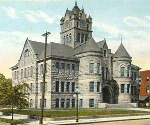
In 1851 the first white settlers came into the area of the present county and settled on Clear Lake. Four years later, on August 7, 1855, the first elections were held and the first legal proceedings occurred in 1857. In the summer of the same year, Livonia was chosen as the new county seat. In 1858, the seat was returned to Mason City. In 1866, the first courthouse was erected from stone at the cost of $600, which was used until 1900. The courthouse still used today was opened on November 17, 1960.
Cerro Gordo County was the site of the airplane crash north of the city of Clear Lake, in which rock and roll stars Buddy Holly, Ritchie Valens, and J.P. "The Big Bopper" Richardson, along with their pilot Roger A. Peterson, were killed on February 3, 1959. The site is located in Grant Township, in the northwestern part of the county.
Geography
According to the U.S. Census Bureau, the county has a total area of 575 square miles (1,490 km2), of which 568 square miles (1,470 km2) is land and 6.8 square miles (18 km2) (1.2%) is water.
Law Enforcement
The Cerro Gordo County Sheriff's Office is currently headed by Sheriff Kevin Pals. The Sheriff's Office provides law enforcement, performs investigations, executes legal processes such as writs, and is responsible for operating the county jail and for the inmates currently in custody.
The Cerro Gordo County Sheriff's Office is located at 17262 Lark Ave in Mason City, IA 50401.
Major highways
Adjacent counties
2010 census
The 2010 census recorded a population of 44,151 in the county, with a population density of 77.73/sq mi (30.012/km2). There were 22,163 housing units, of which 19,350 were occupied.
2000 census
As of the census of 2000, there were 46,447 people, 19,374 households, and 12,399 families residing in the county. The population density was 82 people per square mile (32/km²). There were 21,488 housing units at an average density of 38 per square mile (15/km²). The racial makeup of the county was 96.26% White, 0.80% Black or African American, 0.17% Native American, 0.70% Asian, 0.02% Pacific Islander, 0.88% from other races, and 1.16% from two or more races. 2.78% of the population were Hispanic or Latino of any race.
There were 19,374 households out of which 29.10% had children under the age of 18 living with them, 51.90% were married couples living together, 9.10% had a female householder with no husband present, and 36.00% were non-families. 30.90% of all households were made up of individuals and 13.50% had someone living alone who was 65 years of age or older. The average household size was 2.32 and the average family size was 2.91.
In the county, the population was spread out with 23.80% under the age of 18, 9.00% from 18 to 24, 26.40% from 25 to 44, 23.20% from 45 to 64, and 17.70% who were 65 years of age or older. The median age was 39 years. For every 100 females there were 92.80 males. For every 100 females age 18 and over, there were 89.10 males.
The median income for a household in the county was $35,867, and the median income for a family was $46,099. Males had a median income of $31,790 versus $21,781 for females. The per capita income for the county was $19,184. About 5.90% of families and 8.50% of the population were below the poverty line, including 9.10% of those under age 18 and 8.60% of those age 65 or over.
Townships
Cerro Gordo County is divided into sixteen townships:
Census-designated places
Other unincorporated communities
Population ranking
The population ranking of the following table is based on the 2010 census of Cerro Gordo County.
† county seat
Economy
In September 2016 Cerro Gordo County supervisors voted to appeal the Iowa Department of Natural Resources ’s decision to approve construction of a hog confinement facility near Ventura, Iowa.