
Population 1,163 (2011) Sovereign state United Kingdom Area 6.34 km² Dialling code 01692 | OS grid reference TG385235 Post town NORWICH Local time Saturday 6:50 PM | |
 | ||
Weather 14°C, Wind SW at 14 km/h, 58% Humidity | ||
Sutton is a village (with 486 dwelling houses and a population of 1226) the village population increasing to 1,163 at the 2011 Census, in the English county of Norfolk. It lies next to the Norfolk Broads (Barton Broad to its south-west, and Hickling Broad to its south-east), about 16 miles north-east of Norwich on the A149 road, adjacent to the slightly larger market town of Stalham.
Map of Sutton, UK
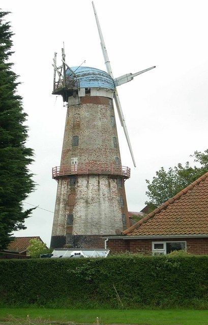
Sutton has a public house and hotel, infant school, garden centre, village hall and a parish church. Nearby is the striking landmark of Sutton Mill. Tourism and recreational facilities include Sutton Pottery, and the Museum of the Broads.
References
Sutton, Norfolk Wikipedia(Text) CC BY-SA