
Population 1,585 (2011) Sovereign state United Kingdom Local time Saturday 6:18 PM Dialling code 01205 | OS grid reference TF283357 Postcode district PE20 | |
 | ||
Weather 13°C, Wind W at 18 km/h, 66% Humidity | ||
Sutterton is a village and rural parish in Lincolnshire, England. The population of the Civil Parish at the 2011 census was 1,585.
Contents
Map of Sutterton, UK
Government
Hitherto, the parish had formed part of Boston Rural District, in Parts of Holland. Holland was one of the three divisions of the traditional County of Lincolnshire. Since the Local Government Act of 1888 Holland had been, in most respects, a county in itself.
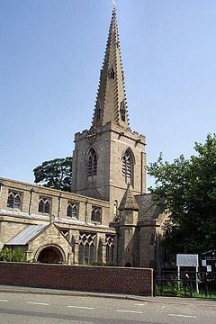
The village is one of eighteen parishes which, together with Boston, form the Lincolnshire Borough of Boston. Local governance has been arranged as such since the reorganization of 1 April 1974, resulting from the Local Government Act 1972. The parish forms part of the 'Five Villages' electoral ward. Sutterton parish church is dedicated to St Mary the Blessed Virgin.
Geography
Sutterton lies approximately 6 miles (10 km) south-west from Boston, near the junction of the A16 and A17 roads, and on the B1397 (formerly A16). The village of Kirton lies 2 miles (3 km) to the north-west. The Spalding bypass opened as the 'Spalding-Sutterton Improvement' in 1995.
Community
Sutterton has a post office and general store one public house and restaurant,fish and chip shop a garden centre also a veterinary practice. Excellent doctors practice, a well attended W.I.and a village hall used in conjunction with the primary school. Close to the east is Algarkirk with which Sutterton shares Sutterton Fourfields Primary School. Before 1970, the two villages also shared the Algarkirk and Sutterton railway station on the Spalding to Boston line, now next to the A16. The village won a best kept village award in 2005.