
Elevation 910 m Local time Saturday 8:35 AM District Surselva District | Canton Graubünden Area 24.2 km² Population 269 (31 Dec 2008) Sfos number 3599 | |
 | ||
Postal code 7110 Peiden7114 Uors7113 Camuns7115 Surcasti7116 Tersnaus Website www.suraua.ch SFSO statistics Weather 11°C, Wind SW at 8 km/h, 54% Humidity | ||
Suraua is a former municipality in the district of Surselva in the canton of Graubünden in Switzerland. The former municipality was formed on January 1, 2002 through the union of Camuns, Surcasti, Tersnaus, and Uors-Peiden. The municipalities of Cumbel, Degen, Lumbrein, Morissen, Suraua, Vignogn, Vella, and Vrin merged on 1 January 2013 into the new municipality of Lumnezia.
Contents
- Map of Suraua Lumnezia Switzerland
- History
- Coat of arms
- Geography
- Demographics
- Heritage sites of national significance
- References
Map of Suraua, Lumnezia, Switzerland
History
The municipality was formed on 1 January 2002 through the merger of Camuns, Surcasti, Tersnaus, and Uors-Peiden.
Coat of arms
The municipal coat of arms is Vert a Bend wavy Azure fimbriated Argent and overall an Annulet of the last and a Mullet of Four Or frettee.
The coat of arms was chosen through a contest where the children of the municipality were invited to submit their design for the new coat of arms following the merger. It symbolizes the geography of the municipality, with a river flowing though the green woods and fields. In the center is a ring that symbolizes the merger of the four former municipalities which are symbolized by the points of the star.
Geography
Suraua had an area, as of 2006, of 24.2 km2 (9.3 sq mi). Of this area, 29.1% is used for agricultural purposes, while 52% is forested. Of the rest of the land, 2% is settled (buildings or roads) and the remainder (16.9%) is non-productive (rivers, glaciers or mountains).
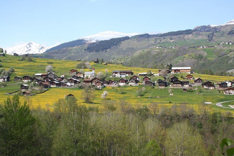
The former municipality is located in the Lugnez sub-district of the Surselva district. It consists of the villages of Camuns, Surcasti, Tersnaus as well as Uors and Peiden, which in 1963 merged to form Uors-Peiden.
Demographics
Suraua had a population (as of 2011) of 247. As of 2008, 2.2% of the population was made up of foreign nationals. Over the last 10 years the population has decreased at a rate of -15%. Most of the population (as of 2000) speaks Romansh (75.9%), with German being second most common (21.0%) and Serbo-Croatian being third ( 1.7%).
As of 2000, the gender distribution of the population was 51.5% male and 48.5% female. The age distribution, as of 2000, in Suraua is; 32 children or 12.8% of the population are between 0 and 9 years old and 29 teenagers or 11.6% are between 10 and 19. Of the adult population, 33 people or 13.2% of the population are between 20 and 29 years old. 43 people or 17.2% are between 30 and 39, 38 people or 15.2% are between 40 and 49, and 22 people or 8.8% are between 50 and 59. The senior population distribution is 29 people or 11.6% of the population are between 60 and 69 years old, 18 people or 7.2% are between 70 and 79, there are 6 people or 2.4% who are between 80 and 89.
In the 2007 federal election the most popular party was the CVP which received 57% of the vote. The next three most popular parties were the SP (19.9%), the SVP (18.2%) and the FDP (4.9%).
In Suraua about 54.5% of the population (between age 25-64) have completed either non-mandatory upper secondary education or additional higher education (either university or a Fachhochschule).
Suraua has an unemployment rate of 0.79%. As of 2005, there were 76 people employed in the primary economic sector and about 21 businesses involved in this sector. 11 people are employed in the secondary sector and there are 6 businesses in this sector. 11 people are employed in the tertiary sector, with 5 businesses in this sector.
The historical population is given in the following table:
^a No data given in reference^b Including St. Martin^c Without St. Martin^d Without Uors, since 1961 merged into Uors-PeidenHeritage sites of national significance
The Church of S. Luregn/St. Lorenz is listed as a Swiss heritage site of national significance.
The tower dates to the 12th Century, and is first mentioned in 1253 as the property of the Freiherr von Überkastel. At that time it was the castle of the Überkastel family. When the family died out in the 15th Century the tower was used as a church tower for the Church of S. Luregn/St. Lorenz. Records of the church have been found from 1345, 1515 and 1520. The gothic church was consecrated in 1520. In 1774 it was rebuilt in a baroque style which remains today. During the restoration, a valuable madonna statue was discovered, which is now in the museum at Disentis Abbey.