
OS grid reference SU6474 Local time Friday 1:47 AM | Civil parish Sulham Sovereign state United Kingdom | |
 | ||
Weather 13°C, Wind S at 13 km/h, 68% Humidity | ||
Sulham is a village and civil parish in West Berkshire, England. The larger village of Tidmarsh is adjacent to Sulham on the west side and of Tilehurst on the east side.
Contents
Map of Sulham, Reading, UK
Governance
The two villages share the combined (civil) parish council of Tidmarsh with Sulham with most local government functions covered out by the local government level(s) above, which is West Berkshire council.
Geography
Clockwise from the west, Sulham is surrounded by the civil parishes serving Tidmarsh, Pangbourne, Purley-on-Thames then the partially parished area and partly in Reading settlement of Tilehurst (to the east) and to the south is Theale which has the local roads' junction with the M4 motorway in its south. The middle of the parish is from north to mid-south occupied by Sulham wood and a similar lengthwise escarpment rises in this area, from 42 metres (the lowest elevation) AOD to 105 metres.
Sulham Woods, a site of Special Scientific Interest (SSSI) form one side of the village, features including many chalk pits and open rolling fields. The place remains architecturally and in land use dominated by the Sulham Hall estate in the north and is otherwise spread out along north-south Sulham Lane which stretches between the villages of Pangbourne and Theale parallel to the River Pang.
Landmarks
Sulham Hall is Grade II* listed as its park and covers around a third of the elongated parish. A feature of the parish and estate is elevated Wilder's Folly in the south, a brick tower or dovecote built in 1769 by Reverend Henry Wilder of Sulham House.
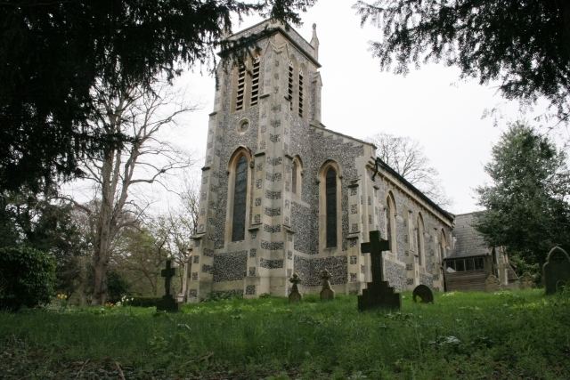
The ecclesiastical parish church is in the main settled area of the village forming a clustered nucleus. It is a listed building in the starting category of the three, grade II, as is Sulham House, converted into four flats. In the middle category (grade II*) in this cluster is Sulham Farmhouse.