
Rural localities 38 | Federal subject Republic of Dagestan Selsoviets 10 Area 666.2 km² | |
 | ||
Municipally incorporated as | ||
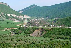
Suleyman-Stalsky District (Russian: Сулейма́н-Ста́льский райо́н; Lezgian: Стӏал Сулейманан район) is an administrative and municipal district (raion), one of the forty-one in the Republic of Dagestan, Russia. It is located in the southeast of the republic. The area of the district is 666.3 square kilometers (257.3 sq mi). Its administrative center is the rural locality (a selo) of Kasumkent. As of the 2010 Census, the total population of the district was 58,835, with the population of Kasumkent accounting for 22.5% of that number.
Contents
- Map of Suleyman Stalsky District Dagestan Republic Russia
- Administrative and municipal status
- References
Map of Suleyman-Stalsky District, Dagestan Republic, Russia
Administrative and municipal status
Within the framework of administrative divisions, Suleyman-Stalsky District is one of the forty-one in the Republic of Dagestan. The district is divided into ten selsoviets which comprise thirty-eight rural localities. As a municipal division, the district is incorporated as Suleyman-Stalsky Municipal District. Its ten selsoviets are incorporated as sixteen rural settlements within the municipal district. The selo of Kasumkent serves as the administrative center of both the administrative and municipal district.