
- elevation 6,976 ft (2,126 m) Length 111 km Basin area 1,279 km² | - elevation 2,211 ft (674 m) Basin area 1,279 km² Country United States of America | |
 | ||
- location near Homedale, Owyhee County, Idaho | ||
Fpv flight of succor creek south west idaho
Succor Creek is a 69.4-mile-long (111.7 km) tributary of the Snake River in the U.S. states of Idaho and Oregon. The creek begins in the Owyhee Mountains in Owyhee County, Idaho. After flowing for about 23 miles (37 km) in Idaho, Succor Creek enters Malheur County, Oregon, where it flows for 39 miles (63 km) before re-entering Idaho for its final 5 miles (8.0 km). It joins the Snake near Homedale, about 413 river miles (665 km) from the larger river's confluence with the Columbia River.
Contents
- Fpv flight of succor creek south west idaho
- Map of Succor Creek Idaho USA
- Weekend wanderings succor creek oregon
- References
Map of Succor Creek, Idaho, USA
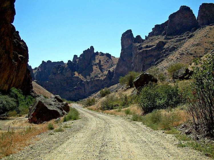
Succor Creek State Natural Area is 30 miles (48 km) south of Nyssa along an unpaved road off Oregon Route 201. It has only primitive camping with no potable water. The canyon in which the natural area is located is known for fossils, geologic formations, and thundereggs, the Oregon state rock.