
Congressional district At-large Website www.sublettewyo.com Founded 1921 | Area 12,784 km² Population 10,041 (2013) | |
 | ||
Rivers Green River, Cliff Creek, Hoback River, Shoal Creek Points of interest Museum of the Mountain, Bridger Wilderness, White Pine Ski Resort, Jackson Hole Iditarod S, Green River Valley Mu | ||
Sublette County is a county located in the U.S. state of Wyoming. As of the 2010 census, the population was 10,247. The county seat is Pinedale. It is a sparsely populated rural county in western Wyoming, along the Green River.
Contents
- Map of Sublette County WY USA
- History
- Geography
- Adjacent counties
- National protected areas
- 2000 census
- 2010 census
- Government
- Towns
- Census designated places
- Unincorporated community
- References
Map of Sublette County, WY, USA
History
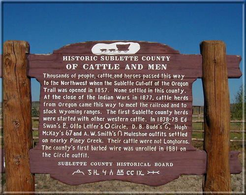
Sublette County was created February 15, 1921, with land detached from Fremont County and Lincoln County, and organized in 1923. Historically, the area was important to the fur trade, and the county itself takes its name from one of Wyoming's early fur traders, William Lewis Sublette. Today the county celebrates its fur trade heritage with the Museum of the Mountain Man in Pinedale.
Geography
According to the U.S. Census Bureau, the county has a total area of 4,936 square miles (12,780 km2), of which 4,887 square miles (12,660 km2) is land and 49 square miles (130 km2) (1.0%) is water.
Adjacent counties
National protected areas
Although the Bridger National Forest and the Teton National Forest have been administratively combined into the Bridger-Teton National Forest, it is important to note that the county contains portions of both original forests.
2000 census
As of the census of 2000, there were 5,920 people, 2,371 households, and 1,707 families residing in the county. Since 2000, however, an oil boom has increased the population by at least 1,000. The population density was 1 person per square mile (0/km²). There were 3,552 housing units at an average density of 1 per square mile (0/km²). The racial makeup of the county was 97.48% White, 0.20% Black or African American, 0.49% Native American, 0.24% Asian, 0.08% Pacific Islander, 0.52% from other races, and 0.98% from two or more races. 1.89% of the population were Hispanic or Latino of any race. 21.7% were of German, 17.5% English, 11.0% American and 10.1% Irish ancestry.
There were 2,371 households out of which 32.70% had children under the age of 18 living with them, 63.30% were married couples living together, 5.30% had a female householder with no husband present, and 28.00% were non-families. 23.60% of all households were made up of individuals and 6.50% had someone living alone who was 65 years of age or older. The average household size was 2.47 and the average family size was 2.91.
In the county, the population was spread out with 25.80% under the age of 18, 6.00% from 18 to 24, 27.50% from 25 to 44, 28.70% from 45 to 64, and 12.00% who were 65 years of age or older. The median age was 40 years. For every 100 females there were 104.30 males. For every 100 females age 18 and over, there were 104.50 males.
The median income for a household in the county was $39,044, and the median income for a family was $45,000. Males had a median income of $35,000 versus $21,109 for females. The per capita income for the county was $20,056. About 7.40% of families and 9.70% of the population were below the poverty line, including 10.40% of those under age 18 and 8.70% of those age 65 or over.
2010 census
As of the 2010 United States Census, there were 10,247 people, 3,906 households, and 2,594 families residing in the county. The population density was 2.1 inhabitants per square mile (0.81/km2). There were 5,770 housing units at an average density of 1.2 per square mile (0.46/km2). The racial makeup of the county was 93.2% white, 0.8% American Indian, 0.5% Asian, 0.3% black or African American, 3.7% from other races, and 1.4% from two or more races. Those of Hispanic or Latino origin made up 6.9% of the population. In terms of ancestry, 31.8% were German, 22.0% were English, 11.3% were Irish, 6.3% were American, and 5.1% were Scottish.
Of the 3,906 households, 32.0% had children under the age of 18 living with them, 56.3% were married couples living together, 5.1% had a female householder with no husband present, 33.6% were non-families, and 25.6% of all households were made up of individuals. The average household size was 2.48 and the average family size was 2.99. The median age was 38.3 years.
The median income for a household in the county was $70,147 and the median income for a family was $81,389. Males had a median income of $51,125 versus $31,940 for females. The per capita income for the county was $31,433. About 2.7% of families and 4.2% of the population were below the poverty line, including 2.2% of those under age 18 and 1.1% of those age 65 or over.
Government
Sublette County is managed by a county commission with three members.
In 2011, Sublette County residents petitioned voters to approve an increase in this number to five as allowed under Wyoming law. The ballot initiative passed and five commissioners were to be seated during the 2012 election cycle.
In early 2012, another ballot initiative was presented to voters requesting their approval to decrease the number of county commissioners back to three even before seating the two additional commissioners. This second special election, held on May 8, 2012, returned the number of commissioners on the council back to the original number of three.