
Population 295 (2011) Sovereign state United Kingdom Dialling code 01636 | OS grid reference SK872488 Post town NEWARK | |
 | ||
UK parliament constituency | ||
Stubton is a small village and civil parish in the South Kesteven district of Lincolnshire, England. The population of the civil parish (including Fenton) at the 2011 census was 295. The village is situated 8 miles (13 km) north from Grantham and 5 miles (8 km) south-east from Newark-on-Trent in Nottinghamshire. Adjacent villages include Claypole, Dry Doddington, Beckingham and Brandon.
Contents
Map of Stubton, Newark, UK
The parish church is a Grade II* listed building dedicated to Saint Martin, built in 1799, with a chancel added in 1869.
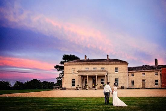
Stubton Hall is a large Grade II listed country house, now a school. It was built in 1813-14 by Sir Jeffry Wyatville.
Community
The ecclesiastical parish of Stubton is part of the Claypole Group of the Deanery of Lovedon.
The Village won the Lincolnshire 'Best Kept Village' competition in 2012.
Stubton has a modern brick-built village hall, built with Millennial funding from the National Lottery.
The village is served on school days by Sleafordian bus route SL10 from Claypole to Sleaford, and on demand by the Call Connect bus service.