
 | ||
Stuart range the enchanting triple
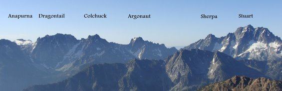
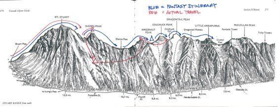
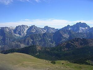
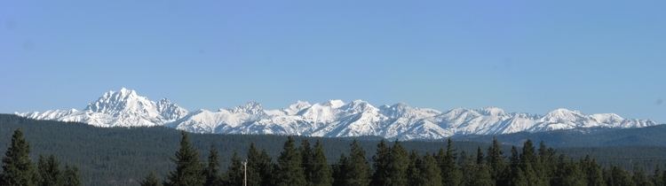
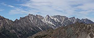
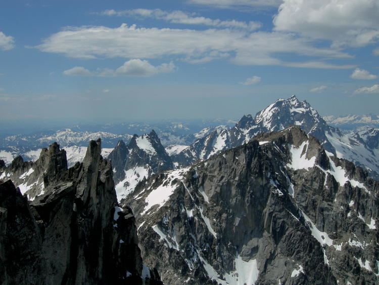
The Stuart Range is a mountain range in central Washington, United States. The range lies within the eastern extent of the Cascade Range immediately southwest of Leavenworth and runs east-west. The western peaks make up a single sharp ridge. The eastern half of the range splits into two parallel ridges, the northern of which is known as the Enchantment Peaks. Between these ridges lies the Enchantment Basin, which holds the dozens of tarns known as the Enchantment Lakes. Collectively, the basin and the encircling eastern peaks of the Stuart Range make up The Enchantments, a well-known backpacking destination. The south face of the Stuart Range falls off steeply to Ingalls Creek, beyond which rise the roughly parallel Wenatchee Mountains.
Contents
- Stuart range the enchanting triple
- Mount stuart and the stuart range
- Partial list of peaksEdit
- Western peaksEdit
- Eastern peaks of south ridgeEdit
- Enchantment Peaks eastern peaks of north ridgeEdit
- GeologyEdit
- References
Mount stuart and the stuart range
Partial list of peaksEdit
A list of notable peaks is below. Within each subsection, peaks are ordered as nearly as possible from west to east.
Western peaksEdit
Eastern peaks of south ridgeEdit
Enchantment Peaks (eastern peaks of north ridge)Edit
GeologyEdit
The Mount Stuart batholith underlies the Stuart Range and the nearby Wenatchee Mountains. The batholith is about 13 by 16 miles in extent. Two plutonic masses are separated by a thin screen of Chiwaukum Schist and rocks of the Ingalls Complex. The more-eastern pluton is 93 million years old, while the more-western rock mass is between 83 and 86 million years old. Exposed rock tends to be quartz diorite and granodiorite.
The range sits near a convergent plate boundary where one plate overrides another. In Western Washington, the North American plate overrides the Juan de Fuca plate, resulting in both volcanic and seismic activity. This convergence has been ongoing for over 200 million years. Continuing uplift and erosion has exposed the underlying granite batholith, making for one of the more spectacular mountain ranges in Washington.