
 | ||
Hiking the enchantments washington state
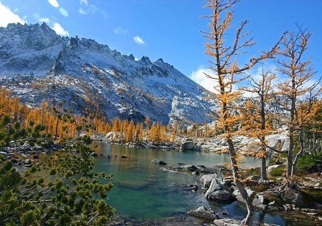
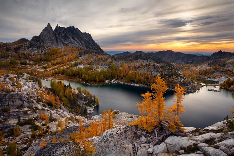
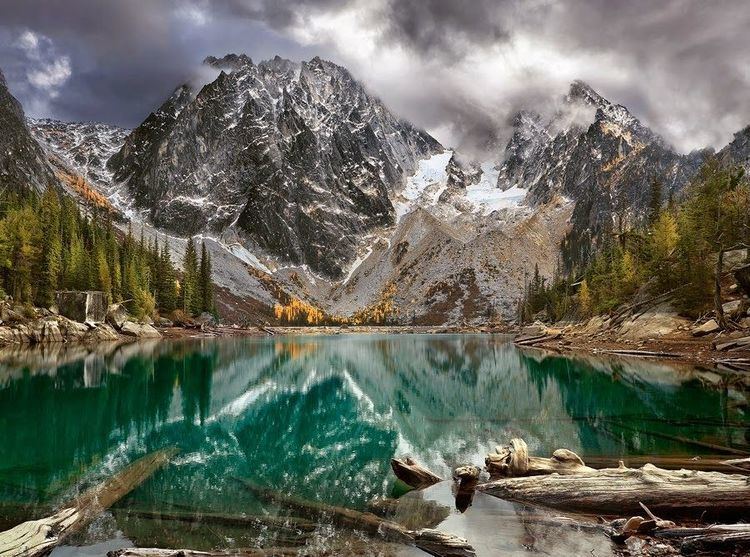
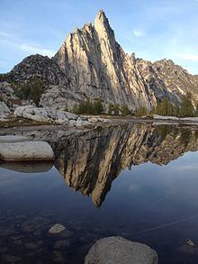
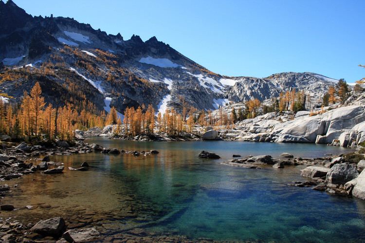
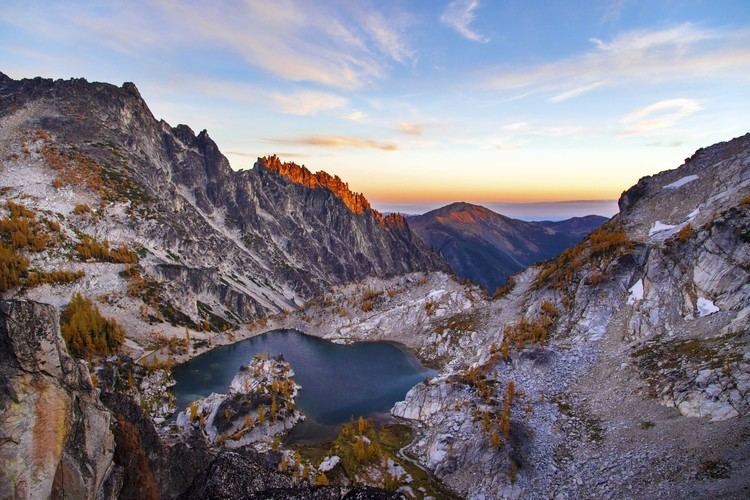
The Enchantments is an area comprising an upper and a lower basin, the lakes and tarns contained within them, and the peaks of the Stuart Range bounding the basins. The area is located entirely within the Alpine Lakes Wilderness about 15 miles (24 km) southwest of Leavenworth, Washington in the United States. The Enchantments is regarded as one of the most spectacular locations in the Cascade Range.
Contents
History
The first European American to discover the area and name it was A.H. Sylvester, topographer for the US Geological Survey and first supervisor of the Wenatchee National Forest. Sylvester visited the middle Enchantment basin and probably did not venture into the upper basin. Snow Creek Glacier covered more of the upper basin at the time than it does today, which may have discouraged him from exploring the higher areas. He is credited with naming some of the features in the region.
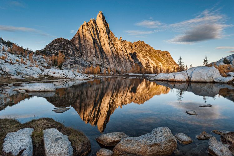
By the 1940s climbers discovered the area and began naming the crags. Bill and Peg Stark of Leavenworth, became frequent visitors who drew upon various mythologies to name features of the landscape. When they made their first visit in the fall of 1959, they were captivated by the golden splendor of the larch trees in the fall, the numerous lakes and tarns, and jagged peaks towering above. They used fairy names such as Gnome Tarn, Troll Sink, Naiad Lake (officially Temple Lake), Sprite and King Arthur legends in the Lower Enchantment Basin because "the lower basin was not as austere as the upper basin," according to Peg. They used Norse names and mythology for features of the upper basin, for example Brynhild Lake (officially Inspiration Lake), Lake Freya (officially Tranquil Lake), and Valhalla Cirque because, Peg said, it felt "as if the Ice Age had just gone off."
The official naming rulings of the US Board on Geographic Names in the 1960s resulted in a mixture of two name sets being adopted as official, particularly for the lakes, but also exemplified by the feature popularly known as Aasgard Pass being officially designated Colchuck Pass. Different sources still use the unofficial names in some contexts. The current policy of not adopting new names for geographic features in wilderness areas probably precludes the rest of the names identified by the Starks from achieving official status.
The number of visitors to the Enchantments grew to large numbers partly due to the fast-growing population of Seattle. By the late 1970s up to 300 people camped in the basin on summer weekends, leaving trash, creating unauthorized paths, and trampling the heather. The Forest Service installed toilets in 1966, restricted horses in 1972, and banned dogs in 1982. In 1987 the Forest Service enacted a permit system for overnight camping in the Enchantments and the Snow Lakes, Stuart Lake, and Colchuck Lake areas.
Hiking
There are two primary approaches to the Enchantments Basin. Both trail heads are accessed via Icicle Creek Road. The Snow Lake trailhead is off Icicle Creek Road at a large parking lot next to the creek. The trail climbs 6.5 miles (10.5 km) to Snow Lake gaining 4,100 feet (1,200 m). From Snow lake the trail ascends over sloping granite rock to the Lower Enchantments. The entire hike is 9 miles (14 km) one-way, with 6,000 feet (1,800 m) of elevation gain to an end elevation of 7,800 feet (2,400 m). This hike usually takes two days each way and is described as "long, steep, and grueling." The alternate route is from the Stuart Lake trail head a couple of miles up Eightmile road off Icicle Creek Road. The trail up to Colchuck Lake is 4.75 miles (7.64 km) long and gains 2,100 feet (640 m); another 1.75 miles (2.82 km) bring hikers to the south end of the lake and Aasgard Pass, which climbs 2,200 feet (670 m) in 0.8 miles (1.3 km). Aasgard Pass is a steep scramble which is dangerous to descend in snow. The Aasgard Pass route has also been described as "in very bad taste" because it bypasses the beauty of the lower basin to get to the upper basin first. The two routes can be combined to form a loop if the hiking party has two cars, a bicycle, or otherwise arranges transportation between the trail heads.
The United States Forest Service restricts access to the Enchantments permit area, which includes five zones. The three most popular zones are the Snow Zone (from Icicle Creek up to Snow Lakes), the Colchuck Zone (the area surrounding Colchuck Lake) and the Core Enchantment Zone (the Upper and Lower Enchantment Basins and surrounding peaks). The other zones are the Stuart Zone (the area around Stuart Lake and the northern approaches to Mount Stuart) and the Eightmile/Caroline Zone (Eightmile Lake, Eightmile Mountain, Cashmere Mountain, and vicinity). In addition, the Forest Service has proposed adding the Ingalls Lake, Headlight Basin, and Mount Stuart areas to the permit area in accordance with a 1993 NEPA decision. The earliest the change could be implemented is 2010.
The 1981 Alpine Lakes Wilderness Plan established a quota of 60 people at one time as the carrying capacity of the Core Enchantment Zone. For overnight camping between May 15 and October 31 hikers in any of the five currently established zones must have permits. 75 percent of the permits for each hiking season are awarded in advance by lottery. The first round of the (very competitive) lottery includes all applications received between February 15, 2016 (12:01 a.m. PT) and March 2, 2016 (11:59 p.m. PT) for the 2016 season. All applications received during this period will be randomly drawn on or around March 6th. The other 25 percent of permits are issued each morning (except Sunday) at 7:45 a.m. at the Leavenworth ranger station for trips beginning the same day. If not enough permits are available for the day's applicants, the permits are awarded by lottery.
The Forest Service has banned dogs in the area, which has allowed the population of mountain goats and ptarmigan to recover.