Harman Patil (Editor)

Struve Geodetic Arc

Updated on
Edit
Like
Comment
Share on FacebookTweet on TwitterShare on LinkedInShare on Reddit
Struve Geodetic Arc whcunescoorguploadsthumbssite118700017500


Similar
  
Paris meridian, Meridian arc, Seconds pendulum

Struve geodetic arc


The Struve Geodetic Arc is a chain of survey triangulations stretching from Hammerfest in Norway to the Black Sea, through ten countries and over 2,820 km, which yielded the first accurate measurement of a meridian.

Contents

The chain was established and used by the German-born Russian scientist Friedrich Georg Wilhelm von Struve in the years 1816 to 1855 to establish the exact size and shape of the earth. At that time, the chain passed merely through two countries: Union of Sweden-Norway and the Russian Empire. The Arc's first point is located in Tartu Observatory in Estonia, where Struve conducted much of his research.

In 2005, the chain was inscribed on the World Heritage List as a memorable ensemble of the chain made up of 34 commemorative plaques or built obelisks out of the original 265 main station points which are marked by drilled holes in rock, iron crosses, cairns, others.

Measurement of the triangulation chain comprises 258 main triangles and 265 geodetic vertices. The northernmost point is located near Hammerfest in Norway and the southernmost point near the Black Sea in Ukraine. This inscription is located in ten countries, the most of any UNESCO World Heritage.

Finnmark 2010 the struve geodetic arc
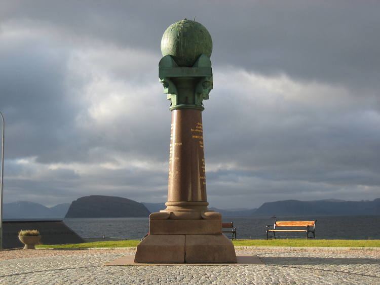

Norway

  • Fuglenes in Hammerfest (70°40′12″N 23°39′48″E)
  • Raipas in Alta (69°56′19″N 23°21′37″E)
  • Luvdiidcohkka in Kautokeino (69°39′52″N 23°36′08″E)
  • Baelljasvarri in Kautokeino (69°01′43″N 23°18′19″E)
  • Sweden

  • "Pajtas-vaara" (Tynnyrilaki) in Kiruna
  • "Kerrojupukka" (Jupukka) in Pajala
  • Pullinki in Övertorneå
  • "Perra-vaara" (Perävaara) in Haparanda
  • Finland

  • Stuor-Oivi (currently Stuorrahanoaivi) in Enontekiö (68°40′57″N 22°44′45″E)
  • Avasaksa (currently Aavasaksa) in Ylitornio (66°23′52″N 23°43′31″E)
  • Torneå (currently Alatornion kirkko) in Tornio (65°49′48″N 24°09′26″E)
  • Puolakka (currently Oravivuori) in Korpilahti (61°55′36″N 25°32′01″E)
  • Porlom II (currently Tornikallio) in Lapinjärvi (60°42′17″N 26°00′12″E)
  • Svartvira (currently Mustaviiri) in Pyhtää (60°16′35″N 26°36′12″E)
  • Russia

  • "Mäki-päälys" (Mäkipäällys (Finland 1917/1920-1940) in Hogland (Suursaari)
  • "Hogland, Z" (Gogland, Tochka Z) in Hogland (60°5′9.8″N 26°57′37.5″E)
  • Estonia

  • "Woibifer" (Võivere) in Väike-Maarja Parish (59°03′28″N 26°20′16″E)
  • "Katko" (Simuna) in Väike-Maarja Parish (59°02′54″N 26°24′51″E)
  • "Dorpat" (Tartu Old Observatory) in Tartu. (58°22′43.64″N 26°43′12.61″E)
  • Latvia

  • "Sestu-Kalns" (Ziestu) in Ērgļu novads (56°50′24″N 25°38′12″E)
  • "Jacobstadt" in Jēkabpils (56°30′05″N 25°51′24″E)
  • Lithuania

  • "Karischki" (Gireišiai) in Panemunėlis (55°54′09″N 25°26′12″E)
  • "Meschkanzi" (Meškonys) in Nemenčinė (54°55′51″N 25°19′00″E)
  • "Beresnäki" (Paliepiukai) in Nemėžis (54°38′04″N 25°25′45″E)
  • Belarus

    19 topographic points of the Struve Geodetic Arc are located in Belarus.

  • "Tupischki" (Tupishki) in Ashmyany district (54°17′30″N 26°2′43″E)
  • "Lopati" (Lopaty) in Zelva district (53°33′38″N 24°52′11″E)
  • "Ossownitza" (Ossovnitsa) in Ivanovo district (52°17′22″N 25°38′58″E)
  • "Tchekutsk" (Chekutsk) in Ivanovo district (52°12′28″N 25°33′23″E)
  • "Leskowitschi" (Leskovichi) in Ivanovo district (52°9′39″N 25°34′17″E)
  • Moldova

  • "Rudi" near Rudi village, Soroca district (48°19′08″N 27°52′36″E)
  • Ukraine

  • Krupi in Krupa, Volyn Oblast (50°41′03″N 25°24′45″E )
  • Katerynivka in Antonivka, Khmelnytsky Oblast (49°33′57″N 26°45′22″E )
  • Felshtyn in Hvardiiske, Khmelnytsky Oblast (49°19′48″N 26°40′55″E )
  • Baranivka in Baranivka, Khmelnytsky Oblast (49°08′55″N 26°59′30″E )
  • Staro-Nekrasivka (Stara Nekrasivka) in Nekrasivka, Odesa Oblast (45°19′54″N 28°55′41″E )
  • Historical

    At publication in 1858, the flattening of the earth was estimated at one part in 294.26. The earth's equatorial radius was estimated at 6,378,360.7 metres.

    In 2005 the work was repeated using satellite navigation. The new flattening estimate was one part in 298.257 222 101 and the equatorial radius was 6,378,136.8 metres.

    An earlier survey, in 1740, had given flattening at one part in 178 and an equatorial radius of 6,396,800 metres.

    Modern

    Northernmost point: Hammerfest (Fuglenes): 70° 40′ 11.23″ N

    Southernmost point: Ismail (Staro-Nekrassowka): 45° 20′ 02.94″ N

    Difference in Geodetic Latitude: 25° 20′ 08.29″

    Distance in kilometres: 2,821.853 ± 0.012

    References

    Struve Geodetic Arc Wikipedia